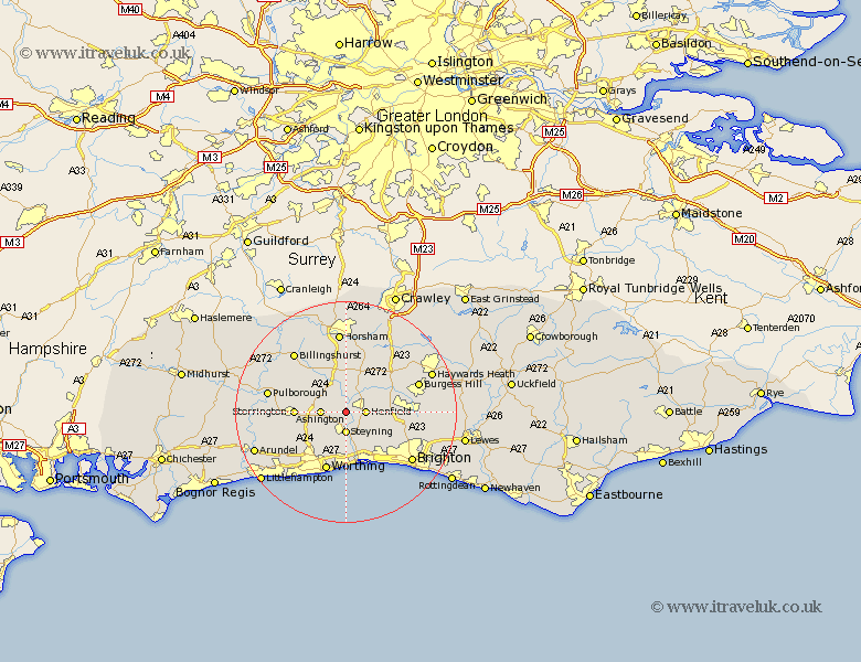
Sussex Map Showing Location of Ashurst
Population: 226
District: Horsham
Easting: 518315 Northing: 114436
Latitude: 50.92 Longitude: -0.32
 = Ashurst
District: Horsham
Easting: 518315 Northing: 114436
Latitude: 50.92 Longitude: -0.32
= Ashurst
This Ashurst map below is supplied by Google. Use the tools in the top left corner to zoom into street level or zoom out for a road map, you may also need to zoom in to see Ashurst on the map. Click and drag the map to move around. If the map fails to load try and refresh your browser or zoom in or out (+ or -).
Update - it seems Google no longer allow people to use their maps for free! This Ashurst map sometimes loads and sometimes gives a error. I am working on a solution.
Closest 30 Towns or Cities to Ashurst (Population over 500)
Henfield 3.5km Steyning 3.71km Upper Beeding 3.71km Upper Bleeding 3.71km Bramber 3.71km Ashington 4.67km West Grinstead 5.68km Washington 6.13km Shipley 6.57km Thakeham 7.25km Cowfold 8.19km Nuthurst 9.34km Storrington 9.35km Findon 9.44km West Chillington 9.53km West Chiltington 9.53km Albourne 9.53km Hurstpierpoint 10.52km Shoreham-by-Sea 10.96km Shoreham by Sea 10.96km Shoreham 10.96km New Shoreham 10.96km Bolney 11.03km Botney 11.03km North Lancing 11.18km Lancing 11.18km Worthing 11.31km Southwater 11.36km Sompting 11.36km Portslade 11.63km