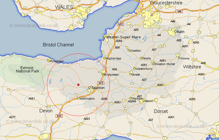
Somerset Map Showing Location of Ash Priors
Population: 123
District: Taunton Deane
Easting: 314728 Northing: 128613
Latitude: 51.05 Longitude: -3.22
 = Ash Priors
District: Taunton Deane
Easting: 314728 Northing: 128613
Latitude: 51.05 Longitude: -3.22
= Ash Priors
This Ash Priors map below is supplied by Google. Use the tools in the top left corner to zoom into street level or zoom out for a road map, you may also need to zoom in to see Ash Priors on the map. Click and drag the map to move around. If the map fails to load try and refresh your browser or zoom in or out (+ or -).
Update - it seems Google no longer allow people to use their maps for free! This Ash Priors map sometimes loads and sometimes gives a error. I am working on a solution.
Closest 30 Towns or Cities to Ash Priors (Population over 500)
Bishops Lydeard 2.98km Oake 3.88km Milverton 4.37km Norton Fitzwarren 5.02km Kingston 7.23km Taunton 7.23km Wiveliscombe 7.23km Trull 8.93km Wellington 9.27km West Buckland 9.55km Spaxton 10.19km Stogumber 10.94km Pitminster 11.61km West Monkton 11.65km Nether Stowey 11.66km Durleigh 13.8km Williton 13.98km Creech St Michael 14.47km Creech St. Michael 14.47km Creech Saint Michael 14.47km North Petherton 15.04km Watchet 15.32km Stokscourey 15.92km Stogursey 15.92km Stoke Courcy 15.92km Bridgwater 16.85km Bridgewater 16.85km Hatch Beauchamp 16.87km Otterhampton 17.5km North Curry 17.87km