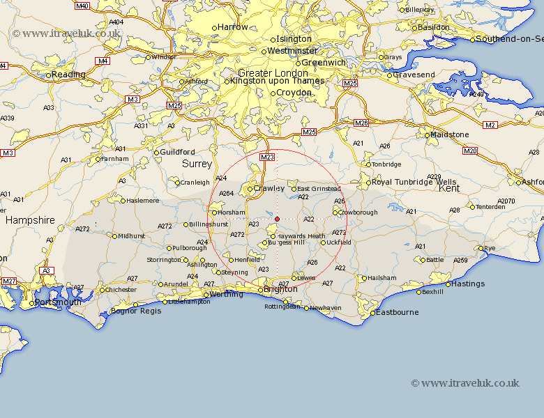
Sussex Map Showing Location of Ardingly
Population: 1931
Area Size (ha): 29
District: Mid Sussex
Easting: 534377 Northing: 127800
Latitude: 51.03 Longitude: -0.08
 = Ardingly
Area Size (ha): 29
District: Mid Sussex
Easting: 534377 Northing: 127800
Latitude: 51.03 Longitude: -0.08
= Ardingly
This Ardingly map below is supplied by Google. Use the tools in the top left corner to zoom into street level or zoom out for a road map, you may also need to zoom in to see Ardingly on the map. Click and drag the map to move around. If the map fails to load try and refresh your browser or zoom in or out (+ or -).
Update - it seems Google no longer allow people to use their maps for free! This Ardingly map sometimes loads and sometimes gives a error. I am working on a solution.
Closest 30 Towns or Cities to Ardingly (Population over 500)
Ardingly 0km Balcombe 2.98km Lindfield 3.88km South Nutfield 3.95km Cuckfield 3.95km Horsted Keynes 5.01km Turners Hill 5.56km Baywards Heath 5.68km Haywards Heath 5.68km Forest Row 6.57km Slaugham 8.16km Burgess Hill 8.19km Worth 8.2km Wivelsfield 9.26km Bolney 9.88km Botney 9.88km Fletching 9.88km Newick 10.19km East Grinstead 10.38km Chailey 11.61km Lower Beeding 11.8km Crawley 12.04km Maresfield 12.92km Ditchelling 13.02km Ditchling 13.02km Albourne 13.14km Hassocks 13.43km Keymer 13.43km Cowfold 13.98km Hurstpierpoint 14.22km