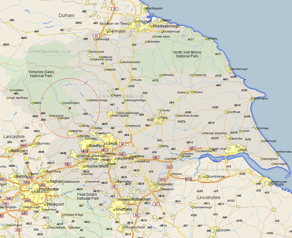
Yorkshire Map Showing Location of Appletreewick
Population: 234
District: Craven
Easting: 405457 Northing: 459725
Latitude: 54.03 Longitude: -1.92
 = Appletreewick
District: Craven
Easting: 405457 Northing: 459725
Latitude: 54.03 Longitude: -1.92
= Appletreewick
This Appletreewick map below is supplied by Google. Use the tools in the top left corner to zoom into street level or zoom out for a road map, you may also need to zoom in to see Appletreewick on the map. Click and drag the map to move around. If the map fails to load try and refresh your browser or zoom in or out (+ or -).
Update - it seems Google no longer allow people to use their maps for free! This Appletreewick map sometimes loads and sometimes gives a error. I am working on a solution.
Closest 30 Towns or Cities to Appletreewick (Population over 500)
Grassington 5.72km Threshfield 6.79km Embsay 8.59km Skipton 9.88km Bewerley 11.26km Addingham 11.33km Dacre 13.19km Gargrave 13.21km Carleton 14.13km Carlton 14.13km Darley 14.15km Ilkley 14.52km Cononley 14.52km Silsden 14.86km Glusburn 15.79km Keighley 16.68km Steeton 16.82km Burley 16.94km Burley in Wharfedale 16.94km Sutton-in-Craven 17.24km Earby 18.42km Birstwith 19.59km Hellifield 20.38km Menston 20.54km Bradley 20.65km Hampsthwaite 20.77km Bingley 21.1km Otley 21.28km Long Preston 22.09km Baildon 22.62km