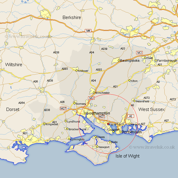
Hampshire Map Showing Location of Fareham
Population: 53698
Area Size (ha): 1437
District: Fareham
Easting: 457484 Northing: 105988
Latitude: 50.85 Longitude: -1.18
 = Fareham
Area Size (ha): 1437
District: Fareham
Easting: 457484 Northing: 105988
Latitude: 50.85 Longitude: -1.18
= Fareham
This Fareham map below is supplied by Google. Use the tools in the top left corner to zoom into street level or zoom out for a road map, you may also need to zoom in to see Fareham on the map. Click and drag the map to move around. If the map fails to load try and refresh your browser or zoom in or out (+ or -).
Update - it seems Google no longer allow people to use their maps for free! This Fareham map sometimes loads and sometimes gives a error. I am working on a solution.
Closest 30 Towns or Cities to Fareham (Population over 500)
Southwick 5.03km Porchester 5.04km Portchester 5.04km Lee-on-Solent 5.68km Lee on the Solent 5.68km Lee-on-the-Solent 5.68km Lee on Solent 5.68km Wickham 5.68km Gosport 6.58km Shidfield 7.42km Shedfield 7.42km Waltham Chase 7.5km Bursledon 8.4km Locks Heath 8.52km Curbridge 8.77km Curdridge 8.77km Swanmore 9.34km Hamble 9.36km Hample 9.36km Botley 9.44km Soberton 9.9km Portsmouth 10.19km Ashurst 10.65km Netley 10.69km Netley Marsh 10.69km Hambledon 11.04km Southsea 11.05km Bishops Waltham 11.36km Bishop's Waltham 11.36km Droxford 11.66km