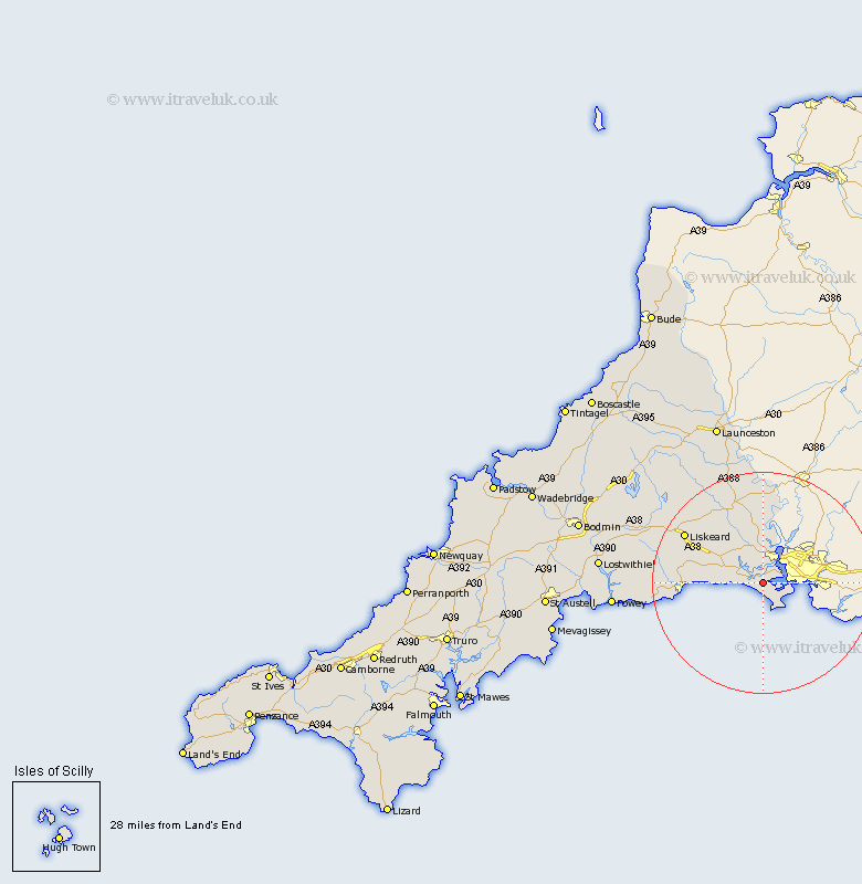
Cornwall Map Showing Location of Antony
Population: 436
District: Caradon
Easting: 240001 Northing: 54354
Latitude: 50.37 Longitude: -4.25
 = Antony
District: Caradon
Easting: 240001 Northing: 54354
Latitude: 50.37 Longitude: -4.25
= Antony
This Antony map below is supplied by Google. Use the tools in the top left corner to zoom into street level or zoom out for a road map, you may also need to zoom in to see Antony on the map. Click and drag the map to move around. If the map fails to load try and refresh your browser or zoom in or out (+ or -).
Update - it seems Google no longer allow people to use their maps for free! This Antony map sometimes loads and sometimes gives a error. I am working on a solution.
Closest 30 Towns or Cities to Antony (Population over 500)
Sherviock 2.36km Sheviock 2.36km Torpoint 3.55km Millbrook 4.73km Saltash 6.04km Bere Alston 13.44km Calstock 13.44km Menheniot 13.94km Morval 14.3km Looe 14.35km West Looe 14.35km Callington 15.24km Duloe 16.65km Liskeard 16.93km Pelynt 20.1km Linkinhorne 20.28km Dobwalls 21.05km Lansallos 22.46km Lanreath 22.53km North Hill 24.16km Lezant 25.1km Lanteglos 26.28km Fowey 27.45km Lewannick 29km South Petherwin 29.36km Lostwithiel 29.77km Launceston 30.77km Tywardreath 30.8km Cardinham 31.16km Cardingham 31.16km