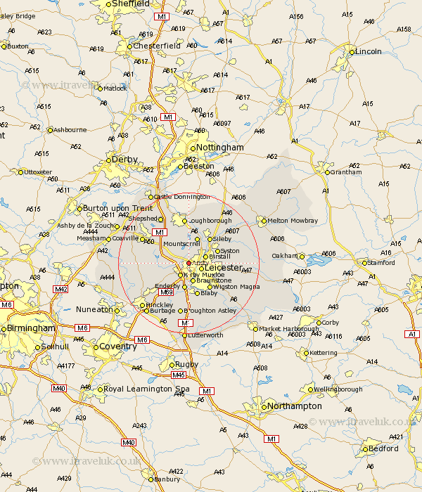
Leicestershire Map Showing Location of Anstey
Population: 6080
Area Size (ha): 118
District: Charnwood
Easting: 455243 Northing: 306159
Latitude: 52.65 Longitude: -1.18
 = Anstey
Area Size (ha): 118
District: Charnwood
Easting: 455243 Northing: 306159
Latitude: 52.65 Longitude: -1.18
= Anstey
This Anstey map below is supplied by Google. Use the tools in the top left corner to zoom into street level or zoom out for a road map, you may also need to zoom in to see Anstey on the map. Click and drag the map to move around. If the map fails to load try and refresh your browser or zoom in or out (+ or -).
Update - it seems Google no longer allow people to use their maps for free! This Anstey map sometimes loads and sometimes gives a error. I am working on a solution.
Closest 30 Towns or Cities to Anstey (Population over 500)
Leiscester 3.85km Leicester 3.85km Kirby Muxloe 4.33km Birstall 4.86km Braunstone 5.67km Rothley 6.5km Markfield 7km Woodhouse 7.5km Enderby 7.5km Desford 7.7km Mountsorrel 7.75km Syston 8.69km Whetstone 9.26km Sileby 9.3km Wigston 9.31km Wigston Magna 9.31km Quorndon 9.33km Narborough 9.33km Barrow 9.53km Barrow upon Soar 9.53km Blaby 9.53km Oadby 10.03km Bagworth 10.12km Glen Parva 10.3km Glen Parka 10.3km Queniborough 10.77km Queniboro 10.77km Newbold Verdon 10.78km Cosby 11.12km Countesthorpe 11.62km