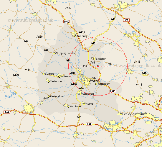
Oxfordshire Map Showing Location of Ambrosden
Population: 1653
Area Size (ha): 45
District: Cherwell
Easting: 460837 Northing: 217240
Latitude: 51.85 Longitude: -1.12
 = Ambrosden
Area Size (ha): 45
District: Cherwell
Easting: 460837 Northing: 217240
Latitude: 51.85 Longitude: -1.12
= Ambrosden
This Ambrosden map below is supplied by Google. Use the tools in the top left corner to zoom into street level or zoom out for a road map, you may also need to zoom in to see Ambrosden on the map. Click and drag the map to move around. If the map fails to load try and refresh your browser or zoom in or out (+ or -).
Update - it seems Google no longer allow people to use their maps for free! This Ambrosden map sometimes loads and sometimes gives a error. I am working on a solution.
Closest 30 Towns or Cities to Ambrosden (Population over 500)
Launton 3.7km Chesterton 5.89km Bicester 6.01km Beckley 8.72km Islip 8.83km Caversfield 9.88km Bletchingdon 10.3km Kirtlington 10.47km Fringford 11.12km Ardley 11.53km Kidlington 12.04km Wheatley 13.03km Tiddington 13.42km Fritwell 13.7km Woodstock 13.74km Yarnton 13.77km Upper Heyford 13.85km Tackley 13.86km Oxford 14.41km Thame 14.41km Steeple Aston 14.61km Cuddesdon 14.87km Great Milton 15km Milton 15km Littlemore 16.34km Bladon 16.46km Garsington 16.84km Great Haseley 17.03km North Hinksey 17.31km Duns Tew 17.52km