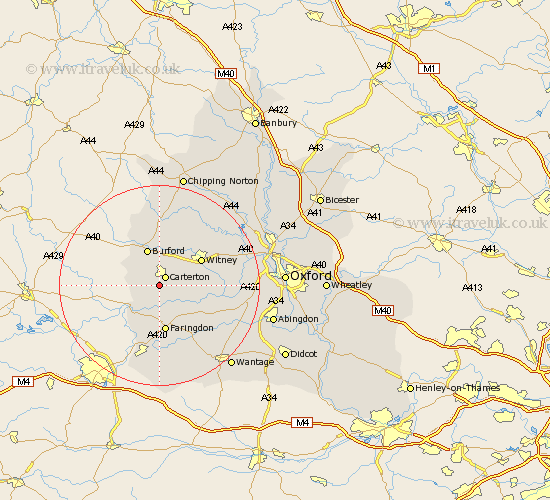
Oxfordshire Map Showing Location of Alvescot
Population: 412
District: West Oxfordshire
Easting: 427620 Northing: 203969
Latitude: 51.73 Longitude: -1.6
 = Alvescot
District: West Oxfordshire
Easting: 427620 Northing: 203969
Latitude: 51.73 Longitude: -1.6
= Alvescot
This Alvescot map below is supplied by Google. Use the tools in the top left corner to zoom into street level or zoom out for a road map, you may also need to zoom in to see Alvescot on the map. Click and drag the map to move around. If the map fails to load try and refresh your browser or zoom in or out (+ or -).
Update - it seems Google no longer allow people to use their maps for free! This Alvescot map sometimes loads and sometimes gives a error. I am working on a solution.
Closest 30 Towns or Cities to Alvescot (Population over 500)
Carterton 2.18km Shilton 3.71km Clanfield 3.88km Brize Norton 4.36km Bampton 4.95km Burford 7.76km Ducklington 8.24km Minster Lovell 8.72km Faringdon 9.33km Witney 9.77km Buckland 10.12km Leafield 10.35km Hailey 10.93km Longworth 12.76km Standlake 12.76km Shipton under Wychwood 13.03km Shipton-under-Wychwood 13.03km Shipton 13.03km Stanford in the Vale 13.08km North Leigh 13.66km Stanton Harcourt 13.77km Kingston Bagpuze 14.64km Kingston Bagpuize 14.64km Watchfield 15km Shrivenham 15.22km Ensham 15.37km Eynsham 15.37km Stonesfield 15.97km Hanborough 16.65km Church Handborough 16.65km