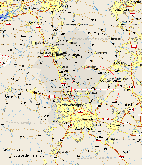
Staffordshire Map Showing Location of Alrewas
Population: 2879
Area Size (ha): 73
District: Lichfield
Easting: 418011 Northing: 313298
Latitude: 52.72 Longitude: -1.73
 = Alrewas
Area Size (ha): 73
District: Lichfield
Easting: 418011 Northing: 313298
Latitude: 52.72 Longitude: -1.73
= Alrewas
This Alrewas map below is supplied by Google. Use the tools in the top left corner to zoom into street level or zoom out for a road map, you may also need to zoom in to see Alrewas on the map. Click and drag the map to move around. If the map fails to load try and refresh your browser or zoom in or out (+ or -).
Update - it seems Google no longer allow people to use their maps for free! This Alrewas map sometimes loads and sometimes gives a error. I am working on a solution.
Closest 30 Towns or Cities to Alrewas (Population over 500)
Edingale 3.85km Elford 3.88km Whittington 4.34km Yoxall 5km Lichfield 6.73km Tatenhill 7.74km Wigginton 8.15km Branston 8.66km Clifton Campville 8.69km Longdon 10.1km Armitage 10.27km Fazeley 11.34km Shenstone 11.47km Anslow 11.62km Tamworth 11.62km Burntwood 11.83km Hammerwich 12.54km Hanbury 12.96km Drayton Bassett 13.03km Colton 13.54km Rolleston 14.12km Rugeley 14.57km Hatton 15km Abbots Bromley 15.01km Tutbury 15.2km Norton Canes 16.16km Brownhills 16.37km Marchington 17.27km Aldridge 17.92km Hednesford 18.06km