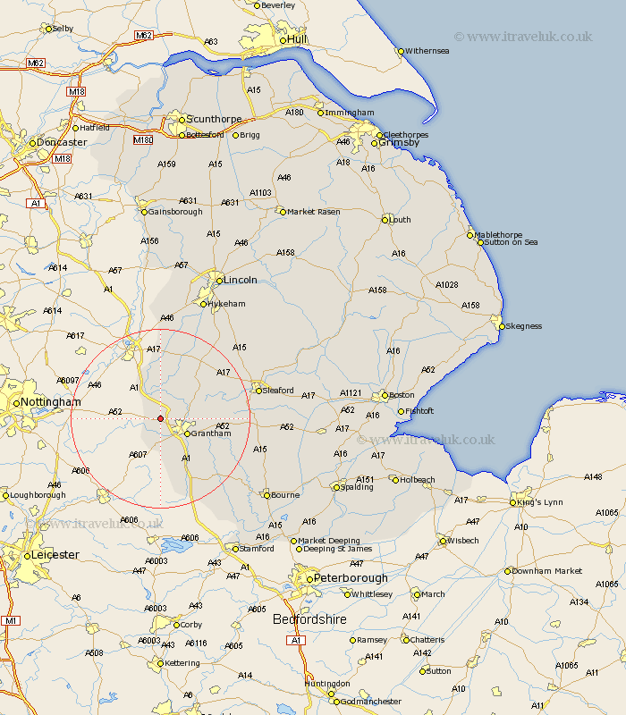
Lincolnshire Map Showing Location of Allington
Population: 728
District: South Kesteven
Easting: 486247 Northing: 338127
Latitude: 52.93 Longitude: -0.72
 = Allington
District: South Kesteven
Easting: 486247 Northing: 338127
Latitude: 52.93 Longitude: -0.72
= Allington
This Allington map below is supplied by Google. Use the tools in the top left corner to zoom into street level or zoom out for a road map, you may also need to zoom in to see Allington on the map. Click and drag the map to move around. If the map fails to load try and refresh your browser or zoom in or out (+ or -).
Update - it seems Google no longer allow people to use their maps for free! This Allington map sometimes loads and sometimes gives a error. I am working on a solution.
Closest 30 Towns or Cities to Allington (Population over 500)
Great Gonerby 3.83km Barrowby 4.32km Long Bennington 4.33km Grantham 6.7km Harlaxton 7.74km Belton 7.82km Claypole 11.18km Caythorpe 12.13km Ancaster 12.83km Fulbeck 14.26km Ropsley 14.52km Colsterworth 16.27km Welbourn 18.56km Corby 20km Cranwell 20.09km Bassingham 21.14km South Witham 21.46km Sleaford 21.6km Leasingham 22.13km Heasingham 22.13km Wellingore 22.23km Folkingham 22.49km Navenby 22.86km Brauncewell 22.98km Swinderby 24.12km Buskington 24.93km Ruskington 24.93km Aubourn 25.01km Castle Bytham 25.42km Bloxholm 26.1km