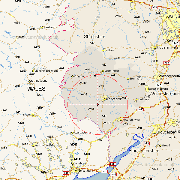
Herefordshire Map Showing Location of Allensmore
Population: 552
Easting: 346249 Northing: 235700
Latitude: 52.02 Longitude: -2.78
 = Allensmore
Easting: 346249 Northing: 235700
Latitude: 52.02 Longitude: -2.78
= Allensmore
This Allensmore map below is supplied by Google. Use the tools in the top left corner to zoom into street level or zoom out for a road map, you may also need to zoom in to see Allensmore on the map. Click and drag the map to move around. If the map fails to load try and refresh your browser or zoom in or out (+ or -).
Update - it seems Google no longer allow people to use their maps for free! This Allensmore map sometimes loads and sometimes gives a error. I am working on a solution.
Closest 30 Towns or Cities to Allensmore (Population over 500)
Kingstone 3.42km Much Dewchurch 4.36km Bullingham 4.92km Madley 4.92km Hereford 5.87km Much Birch 7.19km Credenhill 9.33km Burghill 9.33km Moreton 9.87km Moreton on Lugg 9.87km Moreton-on-Lugg 9.87km Ewyas Harold 10.1km Lugwardine 10.68km Mordiford 10.91km Sutton 11.51km Peterchurch 11.55km Fownhope 12.68km Wellington 13.16km Withington 13.82km Broad Oak 15.01km Bodenham 16.32km Weobley 17.62km Ross on Wye 18.55km Ross-on-wye 18.55km Ross 18.55km Dilwyn 19.38km Walford 19.44km Much Marcle 19.48km Eardisley 19.68km Upton Bishop 19.71km