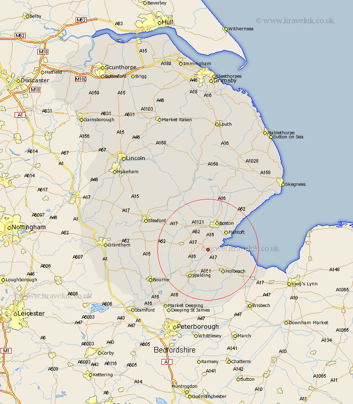
Lincolnshire Map Showing Location of Algarkirk
Population: 406
District: Boston
Easting: 530077 Northing: 333545
Latitude: 52.88 Longitude: -0.07
 = Algarkirk
District: Boston
Easting: 530077 Northing: 333545
Latitude: 52.88 Longitude: -0.07
= Algarkirk
This Algarkirk map below is supplied by Google. Use the tools in the top left corner to zoom into street level or zoom out for a road map, you may also need to zoom in to see Algarkirk on the map. Click and drag the map to move around. If the map fails to load try and refresh your browser or zoom in or out (+ or -).
Update - it seems Google no longer allow people to use their maps for free! This Algarkirk map sometimes loads and sometimes gives a error. I am working on a solution.
Closest 30 Towns or Cities to Algarkirk (Population over 500)
Sutterton 2.17km Kirton 3.88km Frampton 5km Wyberton 6.49km Gosberton 6.71km Quadring 6.96km Surfleet 7.14km Bicker 7.67km Swineshead 7.88km Donington 9.14km Weston 9.26km Fishtoft 10km Holbeach 10.82km Pinchbeck 10.82km Moulton 11.18km Brothertoft 11.34km Whaplode 11.34km Boston 11.61km Frieston 12.13km Freiston 12.13km Spalding 12.99km Butterwick 14.26km Fleet 14.28km Bennington 14.99km Benington 14.99km Lutton 15.41km Gedney 15.78km Hale 16.31km Great Hale 16.31km Leverton 16.41km