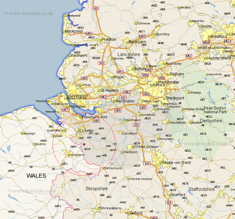
Cheshire Map Showing Location of Aldford
Population: 213
District: Chester
Easting: 342000 Northing: 358108
Latitude: 53.12 Longitude: -2.87
 = Aldford
District: Chester
Easting: 342000 Northing: 358108
Latitude: 53.12 Longitude: -2.87
= Aldford
This Aldford map below is supplied by Google. Use the tools in the top left corner to zoom into street level or zoom out for a road map, you may also need to zoom in to see Aldford on the map. Click and drag the map to move around. If the map fails to load try and refresh your browser or zoom in or out (+ or -).
Update - it seems Google no longer allow people to use their maps for free! This Aldford map sometimes loads and sometimes gives a error. I am working on a solution.
Closest 30 Towns or Cities to Aldford (Population over 500)
Farndon 3.88km Dodleston 5.86km Tattenhall 6.67km Waverton 7.12km Christleton 7.73km Tilston 8.13km Harthill 8.63km Chester 9.84km Great Barrow 10.27km Barrow 10.27km Tarvin 11.41km Mickle Trafford 11.6km Great Saughall 12.43km Saughall 12.43km Malpas 12.97km Mollington 13.39km Tarporley 13.85km Ashton 14.23km Bunbury 14.46km Elton 15.19km Dunham 15.47km Dunham-on-the-Hill 15.47km Dunham on the Hill 15.47km Kelshall Hill 16.52km Kelsall 16.52km Kelsall Hill 16.52km Delamere 17.36km Helsby 17.96km Ellesmere Port 18.66km Little Budworth 19.26km