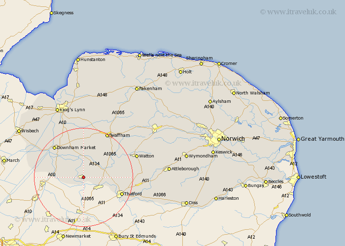
Norfolk Map Showing Location of Feltwell
Population: 2876
Area Size (ha): 139
District: King's Lynn and West Norfolk
Easting: 572004 Northing: 290322
Latitude: 52.48 Longitude: 0.53
 = Feltwell
Area Size (ha): 139
District: King's Lynn and West Norfolk
Easting: 572004 Northing: 290322
Latitude: 52.48 Longitude: 0.53
= Feltwell
This Feltwell map below is supplied by Google. Use the tools in the top left corner to zoom into street level or zoom out for a road map, you may also need to zoom in to see Feltwell on the map. Click and drag the map to move around. If the map fails to load try and refresh your browser or zoom in or out (+ or -).
Update - it seems Google no longer allow people to use their maps for free! This Feltwell map sometimes loads and sometimes gives a error. I am working on a solution.
Closest 30 Towns or Cities to Feltwell (Population over 500)
Hockwold cum Wilton 3.87km Hockwold 3.87km Methwold 3.88km Weeting 6.75km Mundford 8.11km Northwold 8.68km Stoke Ferry 9.34km Southery 10.81km Wereham 11.62km Hilgay 11.68km Denver 15.84km Thetford 16.44km Downham Market 17.19km Marham 18.57km Shouldham 18.84km Welney 19.54km Runcton Holme 20.61km Runcton 20.61km Swaffham 20.61km Ashill 22.22km Watton 22.31km Narborough 22.49km Watlington 22.77km Griston 23.74km Hockham 23.77km Great Palgrave 24.46km Palgrave 24.46km North Runcton 25.02km Upwell 25.04km Necton 25.08km