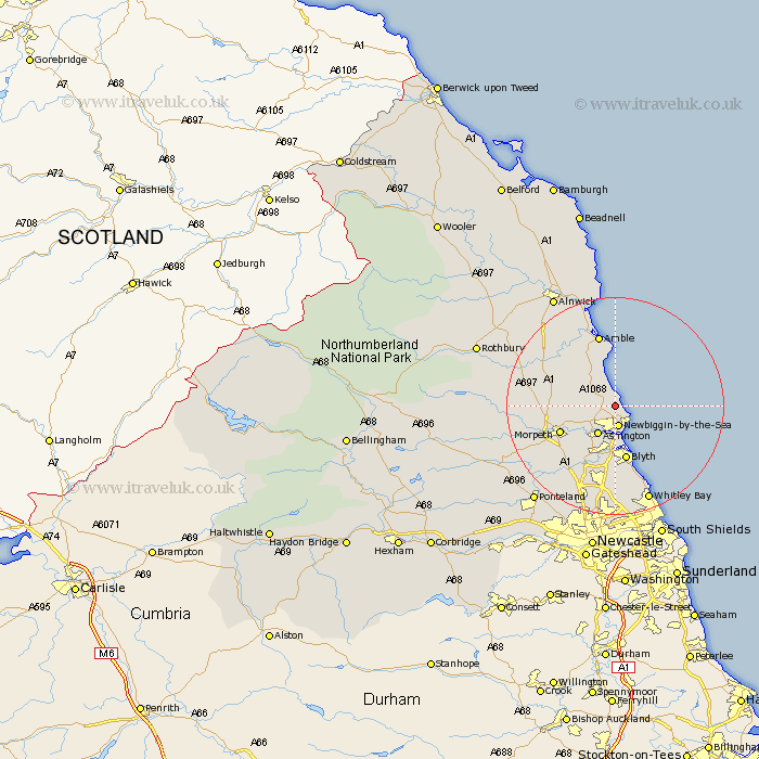
Northumberland Map Showing Location of Lynemouth
Population: 2000
Area Size (ha): 37
District: Castle Morpeth
Easting: 429107 Northing: 591084
Latitude: 55.21 Longitude: -1.54
 = Lynemouth
Area Size (ha): 37
District: Castle Morpeth
Easting: 429107 Northing: 591084
Latitude: 55.21 Longitude: -1.54
= Lynemouth
This Lynemouth map below is supplied by Google. Use the tools in the top left corner to zoom into street level or zoom out for a road map, you may also need to zoom in to see Lynemouth on the map. Click and drag the map to move around. If the map fails to load try and refresh your browser or zoom in or out (+ or -).
Update - it seems Google no longer allow people to use their maps for free! This Lynemouth map sometimes loads and sometimes gives a error. I am working on a solution.
Closest 30 Towns or Cities to Lynemouth (Population over 500)
Ellington 1.58km Newbiggin-by-the-Sea 4.04km Newbiggin by the Sea 4.04km Ashington 6.14km Pegswood 7.74km East Chevington 8.22km Bedlington 9.37km Hebron 9.53km Hepscott 9.79km Morpeth 10.32km Blythe 10.44km Blyth 10.44km East Thirston 11.86km Thirston 11.86km Felton 12.67km Amble 13.61km Longhorsley 14.39km Seaton Sluice 14.53km Stannington 14.85km Dudley 15.39km Swarland 15.48km Warkworth 15.93km Seaton Delaval 16.36km Cramlington 16.48km Longframlington 17.15km Seghill 18.14km Whitley Bay 18.91km Whitley 18.91km Shilbottle 19.27km Lesbury 19.5km