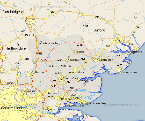
Essex Map Showing Location of White Notley
Population: 500
District: Braintree
Easting: 577973 Northing: 218170
Latitude: 51.83 Longitude: 0.58
 = White Notley
District: Braintree
Easting: 577973 Northing: 218170
Latitude: 51.83 Longitude: 0.58
= White Notley
This White Notley map below is supplied by Google. Use the tools in the top left corner to zoom into street level or zoom out for a road map, you may also need to zoom in to see White Notley on the map. Click and drag the map to move around. If the map fails to load try and refresh your browser or zoom in or out (+ or -).
Update - it seems Google no longer allow people to use their maps for free! This White Notley map sometimes loads and sometimes gives a error. I am working on a solution.
Closest 30 Towns or Cities to White Notley (Population over 500)
Cressing 2.18km Black Notley 2.95km Rayne 3.71km Terling 4.35km Bradwell 4.36km Great Leighs 4.94km Braintree 5.68km Hatfield Peverel 5.68km Rivenhall 5.73km Stisted 6.01km Witham 6.54km Panfield 7.2km Boreham 7.75km Little Waltham 7.81km Coggeshall 7.81km Wickham Bishops 7.98km Kelvedon 8.02km Great Totham 8.83km Totham 8.83km Feering 9.35km Great Waltham 10.72km Broomfield 10.92km Tiptree 10.96km Gosfield 11.12km Little Baddow 11.18km Shalford 12.5km Stebbing 12.72km Felsted 12.73km Barnston 12.73km Great Bardfield 13.07km