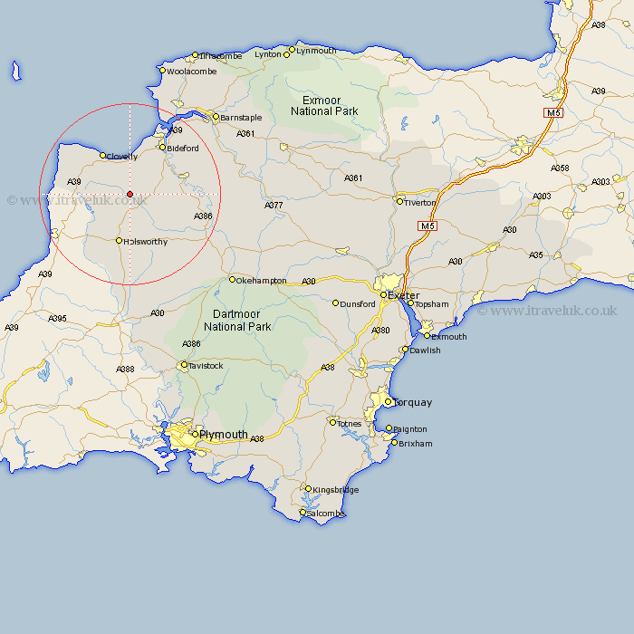
Devon Map Showing Location of West Putford
Population: 181
District: Torridge
Easting: 237173 Northing: 115643
Latitude: 50.92 Longitude: -4.32
 = West Putford
District: Torridge
Easting: 237173 Northing: 115643
Latitude: 50.92 Longitude: -4.32
= West Putford
This West Putford map below is supplied by Google. Use the tools in the top left corner to zoom into street level or zoom out for a road map, you may also need to zoom in to see West Putford on the map. Click and drag the map to move around. If the map fails to load try and refresh your browser or zoom in or out (+ or -).
Update - it seems Google no longer allow people to use their maps for free! This West Putford map sometimes loads and sometimes gives a error. I am working on a solution.
Closest 30 Towns or Cities to West Putford (Population over 500)
Bradworthy 5.03km Parkham 5.68km Woolsery 7.26km Woolfardisworthy 7.26km Buckland Brewer 7.26km Langtree 8.18km Shebbear 10.21km Holsworthy 11.37km Torrington 12.25km Great Torrington 12.25km Bideford 13.14km Pyworthy 14.23km Black Torrington 14.53km Northam 14.74km Hartland 14.9km Bridgerule 15.34km Appledore 16.92km Halwill 17.68km Instow 18.17km Dolton 20.21km Ashwater 20.53km Hatherleigh 20.77km Fremington 21.77km Northlew 21.8km Braunton 22.42km High Bickington 22.87km Tawstock 23.84km Georgeham 25.43km Barrington 25.77km Burrington 25.77km