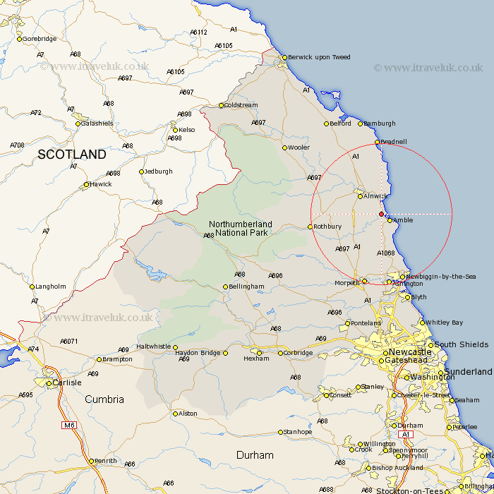
Northumberland Map Showing Location of Warkworth
Population: 1666
Area Size (ha): 48
District: Alnwick
Easting: 424304 Northing: 606289
Latitude: 55.35 Longitude: -1.62
 = Warkworth
Area Size (ha): 48
District: Alnwick
Easting: 424304 Northing: 606289
Latitude: 55.35 Longitude: -1.62
= Warkworth
This Warkworth map below is supplied by Google. Use the tools in the top left corner to zoom into street level or zoom out for a road map, you may also need to zoom in to see Warkworth on the map. Click and drag the map to move around. If the map fails to load try and refresh your browser or zoom in or out (+ or -).
Update - it seems Google no longer allow people to use their maps for free! This Warkworth map sometimes loads and sometimes gives a error. I am working on a solution.
Closest 30 Towns or Cities to Warkworth (Population over 500)
Amble 2.81km Lesbury 3.7km Lisburg 3.7km Shilbottle 4.6km Alnmouth 5.66km Alnwick 7.66km Almwick 7.66km East Chevington 7.71km Thirston 8.53km East Thirston 8.53km Felton 9.1km Swarland 9.24km Longframlington 12.89km Embleton 14.82km Ellington 15.16km Lynemouth 15.93km Longhorsley 16.08km Rothbury 18.3km Hebron 19.01km Newbiggin-by-the-Sea 19.93km Newbiggin by the Sea 19.93km Pegswood 20.41km Ashington 20.78km Morpeth 20.81km Beadnell 22.26km Hepscott 22.34km Bedlington 24.26km North Sunderland 24.3km Blyth 26.32km Blythe 26.32km