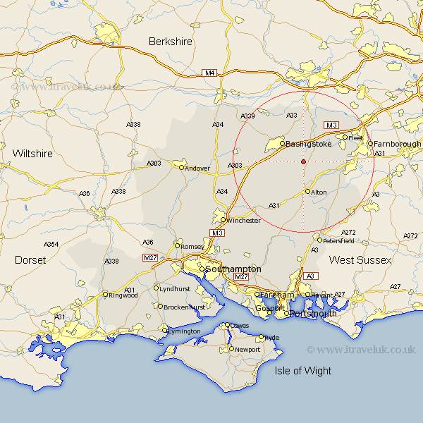
Hampshire Map Showing Location of Upton Grey
Population: 591
District: Basingstoke and Deane
Easting: 469834 Northing: 146921
Latitude: 51.22 Longitude: -1
 = Upton Grey
District: Basingstoke and Deane
Easting: 469834 Northing: 146921
Latitude: 51.22 Longitude: -1
= Upton Grey
This Upton Grey map below is supplied by Google. Use the tools in the top left corner to zoom into street level or zoom out for a road map, you may also need to zoom in to see Upton Grey on the map. Click and drag the map to move around. If the map fails to load try and refresh your browser or zoom in or out (+ or -).
Update - it seems Google no longer allow people to use their maps for free! This Upton Grey map sometimes loads and sometimes gives a error. I am working on a solution.
Closest 30 Towns or Cities to Upton Grey (Population over 500)
Long Sutton 4.64km Odiham 5.94km Basing 6.02km Hook 6.56km Rotherwick 7.76km Basingstoke 8.03km Froyle 8.04km Sherfield upon Loddon 9.33km Sherfield 9.33km Alton 9.35km Winchfield 9.84km Bentley 10.01km Crondall 10.45km Dummer 10.61km Binsted 11.01km Four Marks 11.65km Bramley 12.05km Medstead 12.05km Hartley Wintney 12.32km North Waltham 12.91km Upper Farringdon 13.03km Faringdon 13.03km Farringdon 13.03km Oakley 13.29km Fleet 13.76km Kingsley 14.49km Bordon 15.27km Bordon Camp 15.27km Silchester 15.53km Selborne 15.55km