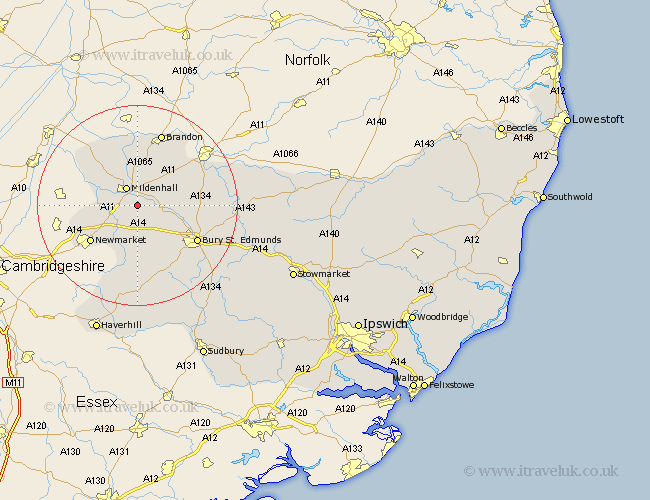
Suffolk Map Showing Location of Tuddenham
Population: 416
District: Forest Heath
Easting: 573789 Northing: 271837
Latitude: 52.32 Longitude: 0.55
 = Tuddenham
District: Forest Heath
Easting: 573789 Northing: 271837
Latitude: 52.32 Longitude: 0.55
= Tuddenham
This Tuddenham map below is supplied by Google. Use the tools in the top left corner to zoom into street level or zoom out for a road map, you may also need to zoom in to see Tuddenham on the map. Click and drag the map to move around. If the map fails to load try and refresh your browser or zoom in or out (+ or -).
Update - it seems Google no longer allow people to use their maps for free! This Tuddenham map sometimes loads and sometimes gives a error. I am working on a solution.
Closest 30 Towns or Cities to Tuddenham (Population over 500)
Mildenhall 4.34km Eriswell 5.67km Gazeley 7.76km Risby 7.94km Moulton 8.69km Barrow 9.55km Fornham All Saints 11.62km Newmarket 11.72km Lake Heath 13.01km Lakenheath 13.01km Bury St. Edmunds 13.55km Bury Saint Edmunds 13.55km Bury St Edmunds 13.55km Barnham 13.64km Chevington 13.75km Exning 14.69km Brandon 15.5km Chedburgh 15.51km Great Barton 15.75km Troston 15.86km Honington 17.09km Rushbrooke 18.47km Wickhambrook 18.57km Ixworth 19.35km Thurston 19.6km Pakenham 20.06km Bardwell 20.39km Bradfield 21.4km Bradfield Saint George 21.4km Bradfield St. George 21.4km