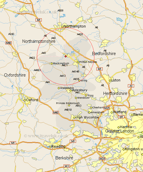
Buckinghamshire Map Showing Location of Stony Stratford
Population: 54530
Area Size (ha): 1723
Easting: 478851 Northing: 239738
Latitude: 52.05 Longitude: -0.85
 = Stony Stratford
Area Size (ha): 1723
Easting: 478851 Northing: 239738
Latitude: 52.05 Longitude: -0.85
= Stony Stratford
This Stony Stratford map below is supplied by Google. Use the tools in the top left corner to zoom into street level or zoom out for a road map, you may also need to zoom in to see Stony Stratford on the map. Click and drag the map to move around. If the map fails to load try and refresh your browser or zoom in or out (+ or -).
Update - it seems Google no longer allow people to use their maps for free! This Stony Stratford map sometimes loads and sometimes gives a error. I am working on a solution.
Closest 30 Towns or Cities to Stony Stratford (Population over 500)
Wolverton 2.28km Castlethorpe 3.87km Bradwell 4.92km Shenley 5.88km Shenley Church End 5.88km Hanslope 6.01km Great Linford 7.08km Shenley Brook End 7.96km Akeley 8.19km Thornborough 8.71km Milton Keynes 9.32km Great Horwood 9.33km Stoke Goldington 9.35km Maids Moreton 9.73km Newport Pagnell 9.84km Buckingham 10.68km Newton Longville 10.88km Bletchley 10.9km Simpson 10.91km Winslow 11.18km Padbury 11.52km Sherington 11.66km Stowe 11.99km Wavendon 13.08km Mursley 13.18km Gawcott 13.83km North Crawley 14.16km Stoke Hammond 14.39km Bow Brickhill 14.57km Olney 15.12km