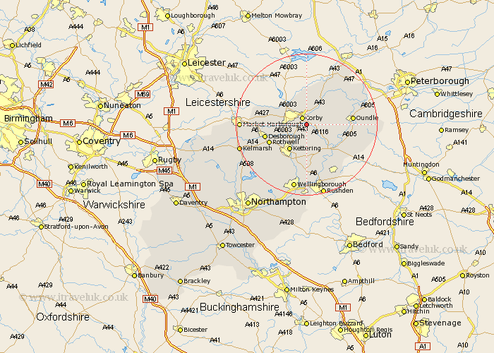
Northamptonshire Map Showing Location of Stanion
Population: 873
District: Corby
Easting: 491700 Northing: 286315
Latitude: 52.47 Longitude: -0.65
 = Stanion
District: Corby
Easting: 491700 Northing: 286315
Latitude: 52.47 Longitude: -0.65
= Stanion
This Stanion map below is supplied by Google. Use the tools in the top left corner to zoom into street level or zoom out for a road map, you may also need to zoom in to see Stanion on the map. Click and drag the map to move around. If the map fails to load try and refresh your browser or zoom in or out (+ or -).
Update - it seems Google no longer allow people to use their maps for free! This Stanion map sometimes loads and sometimes gives a error. I am working on a solution.
Closest 30 Towns or Cities to Stanion (Population over 500)
Corby 2.16km Weldon 2.16km Brigstock 3.86km Geddington 4.35km Cottingham 7.02km Caldecott 7.16km Gretton 7.49km Kettering 8.69km Wilbarston 10.33km Thrapston 10.84km Rowell 11.59km Rothwell 11.59km Desborough 11.89km Islip 12.19km Woodford 12.48km Oundle 12.55km Burton Latimer 13.03km Isham 13.41km Titchmarsh 13.52km Broughton 13.65km Ringstead 14.64km Finedon 14.88km Kings Cliffe 15.06km King's Cliffe 15.06km Raunds 16.81km Irthlingborough 17.02km Warmington 17.33km Stanwick 18.01km Nassington 18.31km Walgrave 18.65km