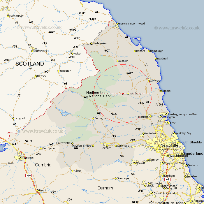
Northumberland Map Showing Location of Snitter
Population: 114
District: Alnwick
Easting: 403172 Northing: 602518
Latitude: 55.32 Longitude: -1.95
 = Snitter
District: Alnwick
Easting: 403172 Northing: 602518
Latitude: 55.32 Longitude: -1.95
= Snitter
This Snitter map below is supplied by Google. Use the tools in the top left corner to zoom into street level or zoom out for a road map, you may also need to zoom in to see Snitter on the map. Click and drag the map to move around. If the map fails to load try and refresh your browser or zoom in or out (+ or -).
Update - it seems Google no longer allow people to use their maps for free! This Snitter map sometimes loads and sometimes gives a error. I am working on a solution.
Closest 30 Towns or Cities to Snitter (Population over 500)
Rothbury 3.16km Longframlington 11.18km Swarland 13.84km Longhorsley 14.86km Felton 16.26km Thirston 17.28km East Thirston 17.28km Otterburn 17.67km Shilbottle 17.76km Alnwick 18.32km Almwick 18.32km Warkworth 21.41km Lesbury 22.34km Lisburg 22.34km Hebron 22.49km Amble 23.27km East Chevington 23.51km Morpeth 23.75km Alnmouth 23.98km Wooler 24.29km Bellingham 25.81km Pegswood 26.1km Hepscott 26.56km Ellington 26.71km Embleton 28.04km Lynemouth 28.27km Ashington 28.64km Stannington 30.06km Newbiggin by the Sea 30.64km Newbiggin-by-the-Sea 30.64km