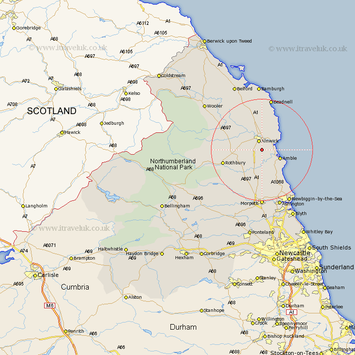
Northumberland Map Showing Location of Shilbottle
Population: 1349
District: Alnwick
Easting: 420069 Northing: 608126
Latitude: 55.37 Longitude: -1.68
 = Shilbottle
District: Alnwick
Easting: 420069 Northing: 608126
Latitude: 55.37 Longitude: -1.68
= Shilbottle
This Shilbottle map below is supplied by Google. Use the tools in the top left corner to zoom into street level or zoom out for a road map, you may also need to zoom in to see Shilbottle on the map. Click and drag the map to move around. If the map fails to load try and refresh your browser or zoom in or out (+ or -).
Update - it seems Google no longer allow people to use their maps for free! This Shilbottle map sometimes loads and sometimes gives a error. I am working on a solution.
Closest 30 Towns or Cities to Shilbottle (Population over 500)
Alnwick 3.85km Almwick 3.85km Lesbury 4.6km Lisburg 4.6km Warkworth 4.6km Alnmouth 6.44km Amble 7.33km Swarland 8.06km Thirston 9.27km East Thirston 9.27km Felton 9.33km Longframlington 11.23km East Chevington 11.23km Embleton 13.63km Rothbury 14.79km Longhorsley 15.74km Ellington 18.24km Lynemouth 19.27km Hebron 20.39km Beadnell 20.62km Morpeth 22.24km North Sunderland 22.26km Pegswood 22.46km Newbiggin-by-the-Sea 23.12km Newbiggin by the Sea 23.12km Ashington 23.37km Hepscott 24.19km Bedlington 26.77km Wooler 27.24km Belford 27.61km