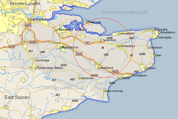
Kent Map Showing Location of Selling
Population: 701
District: Swale
Easting: 603447 Northing: 156047
Latitude: 51.27 Longitude: 0.92
 = Selling
District: Swale
Easting: 603447 Northing: 156047
Latitude: 51.27 Longitude: 0.92
= Selling
This Selling map below is supplied by Google. Use the tools in the top left corner to zoom into street level or zoom out for a road map, you may also need to zoom in to see Selling on the map. Click and drag the map to move around. If the map fails to load try and refresh your browser or zoom in or out (+ or -).
Update - it seems Google no longer allow people to use their maps for free! This Selling map sometimes loads and sometimes gives a error. I am working on a solution.
Closest 30 Towns or Cities to Selling (Population over 500)
Selling 0km Dunkirk 4.99km Ospringe 5.08km Chilham 5.09km Faversham 5.68km Oare 6.02km Chartham 7.2km Harbledown 8.32km Wye 9.35km Blean 9.98km Linsted 9.99km Lynsted 9.99km Teynham 10.16km Doddington 10.44km Petham 10.82km Canterbury 10.96km Charing 11km Lower Hardres 11.08km Hackington 11.74km Bapchild 11.82km Kennington 13.18km Sittingbourne 13.75km Chestfield 13.95km Stelling 13.97km Sturry 14.03km Bridge 14.41km Lenham 14.41km Hothfield 14.73km Whitstable 14.77km Leysdown on Sea 14.82km