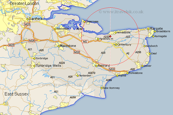
Kent Map Showing Location of Seasalter
District: Canterbury
Easting: 610116 Northing: 163732
Latitude: 51.33 Longitude: 1.02
 = Seasalter
Easting: 610116 Northing: 163732
Latitude: 51.33 Longitude: 1.02
= Seasalter
This Seasalter map below is supplied by Google. Use the tools in the top left corner to zoom into street level or zoom out for a road map, you may also need to zoom in to see Seasalter on the map. Click and drag the map to move around. If the map fails to load try and refresh your browser or zoom in or out (+ or -).
Update - it seems Google no longer allow people to use their maps for free! This Seasalter map sometimes loads and sometimes gives a error. I am working on a solution.
Closest 30 Towns or Cities to Seasalter (Population over 500)
Chestfield 3.94km Blean 4.37km Whitstable 4.66km Harbledown 5.68km Dunkirk 6.02km Hackington 7.24km Canterbury 7.42km Faversham 8.31km Sturry 8.9km Herne Bay 8.91km Chartham 9.26km Oare 9.45km Broomfield 9.48km Selling 10.16km Leysdown-on-Sea 10.16km Leysdown 10.16km Leysdown on Sea 10.16km Hoath 10.42km Warden 10.98km Ospringe 11.06km Chilham 11.65km Lower Hardres 11.65km Chislet 12.74km Eastchurch 12.78km Littlebourne 12.79km Bridge 13.12km Petham 13.17km Teynham 13.89km Preston 15.51km Wingham 15.75km