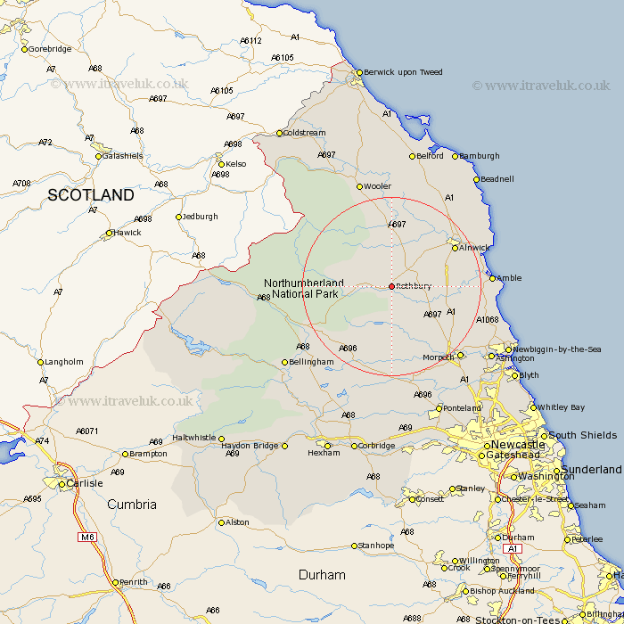
Northumberland Map Showing Location of Rothbury
Population: 1790
Area Size (ha): 86
District: Alnwick
Easting: 406345 Northing: 602522
Latitude: 55.32 Longitude: -1.9
 = Rothbury
Area Size (ha): 86
District: Alnwick
Easting: 406345 Northing: 602522
Latitude: 55.32 Longitude: -1.9
= Rothbury
This Rothbury map below is supplied by Google. Use the tools in the top left corner to zoom into street level or zoom out for a road map, you may also need to zoom in to see Rothbury on the map. Click and drag the map to move around. If the map fails to load try and refresh your browser or zoom in or out (+ or -).
Update - it seems Google no longer allow people to use their maps for free! This Rothbury map sometimes loads and sometimes gives a error. I am working on a solution.
Closest 30 Towns or Cities to Rothbury (Population over 500)
Longframlington 8.27km Swarland 10.71km Longhorsley 12.54km Felton 13.19km Thirston 14.21km East Thirston 14.21km Shilbottle 14.79km Alnwick 15.67km Almwick 15.67km Warkworth 18.3km Lesbury 19.38km Lisburg 19.38km Amble 20.12km Hebron 20.21km Otterburn 20.23km East Chevington 20.39km Alnmouth 21.1km Morpeth 21.61km Pegswood 23.75km Ellington 23.87km Hepscott 24.39km Wooler 24.9km Lynemouth 25.41km Embleton 25.75km Ashington 26.15km Newbiggin by the Sea 27.96km Newbiggin-by-the-Sea 27.96km Bellingham 28.11km Stannington 28.28km Bedlington 28.59km