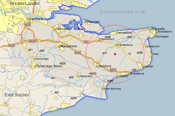
Kent Map Showing Location of Petham
Population: 673
District: Canterbury
Easting: 612976 Northing: 150866
Latitude: 51.22 Longitude: 1.05
 = Petham
District: Canterbury
Easting: 612976 Northing: 150866
Latitude: 51.22 Longitude: 1.05
= Petham
This Petham map below is supplied by Google. Use the tools in the top left corner to zoom into street level or zoom out for a road map, you may also need to zoom in to see Petham on the map. Click and drag the map to move around. If the map fails to load try and refresh your browser or zoom in or out (+ or -).
Update - it seems Google no longer allow people to use their maps for free! This Petham map sometimes loads and sometimes gives a error. I am working on a solution.
Closest 30 Towns or Cities to Petham (Population over 500)
Lower Hardres 2.18km Stelling 3.89km Chartham 4.37km Bridge 5km Chilham 6.09km Canterbury 6.87km Harbledown 7.5km Hackington 7.76km Sturry 8.74km Dunkirk 8.74km Elham 8.75km Wye 8.94km Blean 9.26km Littlebourne 9.84km Brabourne 9.91km Selling 10.82km Lyminge 11.36km Hinxhill 12.33km Smeeth 12.55km Wingham 12.87km Swingfield 13.13km Shepherdswell 13.3km Sibertswold 13.3km Sellindge 13.44km Sellinge 13.44km Kennington 13.78km Staple 14.41km Ashford 14.87km Chestfield 14.87km Coldred 15.01km