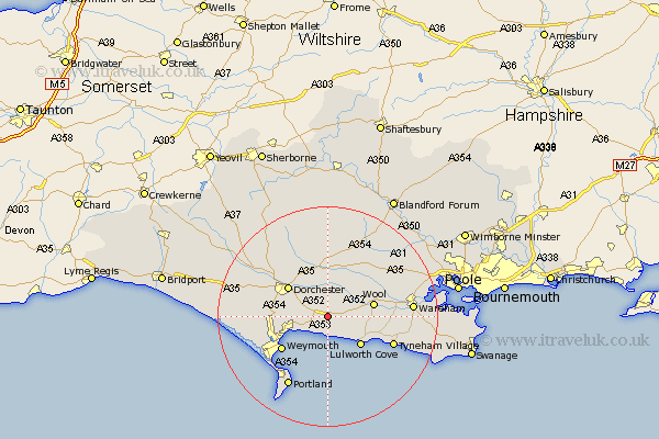
Dorset Map Showing Location of Owermoigne
Population: 450
District: West Dorset
Easting: 376445 Northing: 85343
Latitude: 50.67 Longitude: -2.33
 = Owermoigne
District: West Dorset
Easting: 376445 Northing: 85343
Latitude: 50.67 Longitude: -2.33
= Owermoigne
This Owermoigne map below is supplied by Google. Use the tools in the top left corner to zoom into street level or zoom out for a road map, you may also need to zoom in to see Owermoigne on the map. Click and drag the map to move around. If the map fails to load try and refresh your browser or zoom in or out (+ or -).
Update - it seems Google no longer allow people to use their maps for free! This Owermoigne map sometimes loads and sometimes gives a error. I am working on a solution.
Closest 30 Towns or Cities to Owermoigne (Population over 500)
Upton 3.12km Broadmayne 3.98km Osmington 4.4km Winfrith Newburgh 5.05km Winfrith 5.05km Preston 6.16km Bovington Camp 6.94km Overcombe 7.74km West Lulworth 8.09km Lulworth Cove 8.09km Bincombe 8.43km Wool 8.52km Dorchester 8.97km Puddletown 9.34km Piddletown 9.34km Weymouth 10.37km Charminster 11.06km Milborne Saint Andrew 11.66km Milborne St Andrew 11.66km Milborne St. Andrew 11.66km Milborne 11.66km Bere Regis 12.38km Chickerell 13km West Chickerel 13km Piddletrenthide 14.23km Puddletrenthide 14.23km Winterborne Kingston 14.55km Island of Portland 14.77km Isle of Portland 14.77km Portland 14.77km