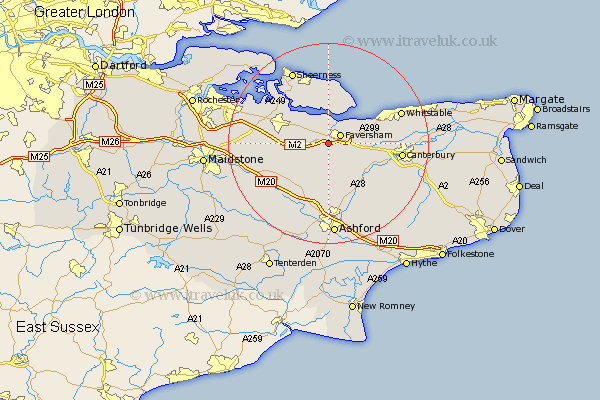
Kent Map Showing Location of Ospringe
Population: 715
District: Swale
Easting: 599815 Northing: 159611
Latitude: 51.3 Longitude: 0.87
 = Ospringe
District: Swale
Easting: 599815 Northing: 159611
Latitude: 51.3 Longitude: 0.87
= Ospringe
This Ospringe map below is supplied by Google. Use the tools in the top left corner to zoom into street level or zoom out for a road map, you may also need to zoom in to see Ospringe on the map. Click and drag the map to move around. If the map fails to load try and refresh your browser or zoom in or out (+ or -).
Update - it seems Google no longer allow people to use their maps for free! This Ospringe map sometimes loads and sometimes gives a error. I am working on a solution.
Closest 30 Towns or Cities to Ospringe (Population over 500)
Oare 2.19km Faversham 2.97km Teynham 5.08km Selling 5.08km Linsted 5.79km Lynsted 5.79km Bapchild 7.19km Doddington 7.88km Dunkirk 8.32km Sittingbourne 8.91km Chilham 10.17km Tunstall 10.59km Eastchurch 11.12km Warden 11.36km Bredgar 11.59km Leysdown 11.65km Leysdown-on-Sea 11.65km Leysdown on Sea 11.65km Borden 11.73km Harbledown 11.74km Chartham 11.82km Iwade 11.87km Charing 12.05km Blean 12.75km Lenham 12.8km Bobbing 12.85km Minster 13.43km Wye 13.78km Canterbury 14.6km Queenborough 14.72km