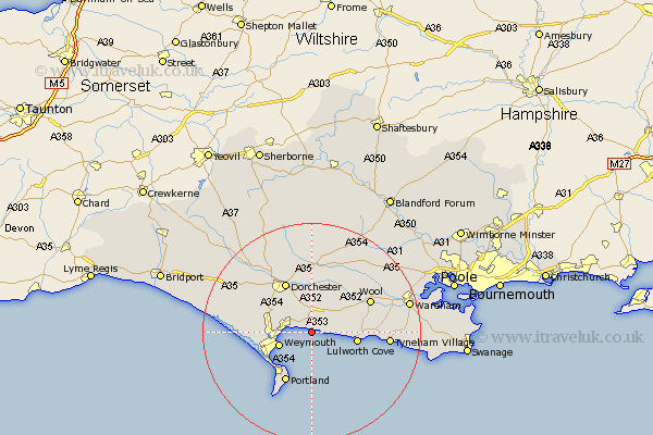
Dorset Map Showing Location of Osmington
Population: 609
District: West Dorset
Easting: 374071 Northing: 81640
Latitude: 50.63 Longitude: -2.37
 = Osmington
District: West Dorset
Easting: 374071 Northing: 81640
Latitude: 50.63 Longitude: -2.37
= Osmington
This Osmington map below is supplied by Google. Use the tools in the top left corner to zoom into street level or zoom out for a road map, you may also need to zoom in to see Osmington on the map. Click and drag the map to move around. If the map fails to load try and refresh your browser or zoom in or out (+ or -).
Update - it seems Google no longer allow people to use their maps for free! This Osmington map sometimes loads and sometimes gives a error. I am working on a solution.
Closest 30 Towns or Cities to Osmington (Population over 500)
Upton 1.5km Preston 3.99km Overcombe 4.61km Broadmayne 5.68km Bincombe 6.16km Weymouth 6.42km Winfrith 7.29km Winfrith Newburgh 7.29km Lulworth Cove 8.43km West Lulworth 8.43km West Chickerel 9.58km Chickerell 9.58km Island of Portland 10.39km Isle of Portland 10.39km Portland 10.39km Dorchester 10.4km Fortuneswell 10.97km Bovington Camp 11.07km Weston 11.85km Wool 12.13km Charminster 12.57km Easton 12.58km Piddletown 13.03km Puddletown 13.03km Portisham 14.58km Portesham 14.58km Milborne St Andrew 15.95km Milborne St. Andrew 15.95km Milborne 15.95km Milborne Saint Andrew 15.95km