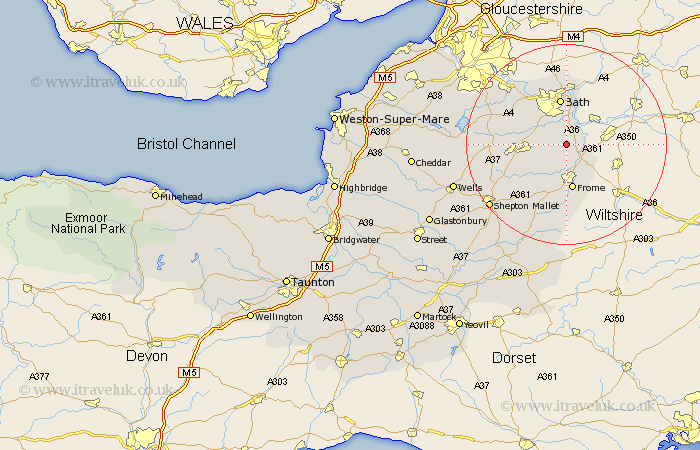
Somerset Map Showing Location of Norton St Philip
Population: 848
District: Mendip
Easting: 376763 Northing: 155761
Latitude: 51.3 Longitude: -2.33
 = Norton St Philip
District: Mendip
Easting: 376763 Northing: 155761
Latitude: 51.3 Longitude: -2.33
= Norton St Philip
This Norton St Philip map below is supplied by Google. Use the tools in the top left corner to zoom into street level or zoom out for a road map, you may also need to zoom in to see Norton St Philip on the map. Click and drag the map to move around. If the map fails to load try and refresh your browser or zoom in or out (+ or -).
Update - it seems Google no longer allow people to use their maps for free! This Norton St Philip map sometimes loads and sometimes gives a error. I am working on a solution.
Closest 30 Towns or Cities to Norton St Philip (Population over 500)
Wellow 3.94km Rode 3.94km Road 3.94km Freshford 4.37km Beckington 5.08km Kilmersdon 7.88km Kilmersden 7.88km Camerton 8.32km Mells 8.75km Bathampton 9.33km Frome 9.34km Bath 9.34km Timsbury 10.59km Batheaston 11.18km Bathford 11.36km Paulton 11.59km Nunney 11.65km Coleford 11.69km Farmboro 12.16km Farmborough 12.16km Stratton-on-the-Fosse 12.17km Chilcompton 12.17km Stratton on the Fosse 12.17km Stratton 12.17km Leigh on Mendip 12.32km Leigh-on-Mendip 12.32km Leigh 12.32km Leigh upon Mendip 12.32km Holcombe 12.8km Saltford 13.76km