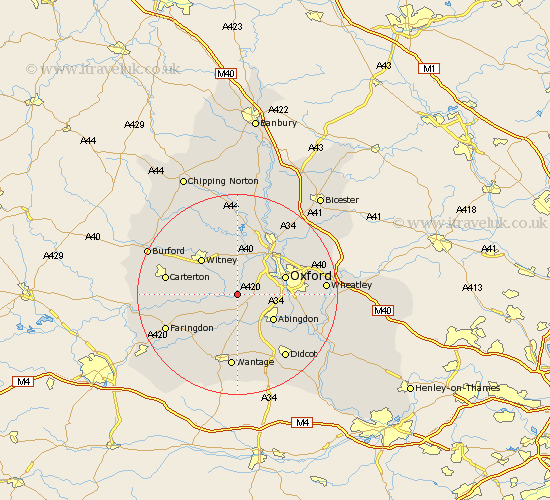
Oxfordshire Map Showing Location of Northmoor
Population: 363
District: West Oxfordshire
Easting: 442597 Northing: 202227
Latitude: 51.72 Longitude: -1.38
 = Northmoor
District: West Oxfordshire
Easting: 442597 Northing: 202227
Latitude: 51.72 Longitude: -1.38
= Northmoor
This Northmoor map below is supplied by Google. Use the tools in the top left corner to zoom into street level or zoom out for a road map, you may also need to zoom in to see Northmoor on the map. Click and drag the map to move around. If the map fails to load try and refresh your browser or zoom in or out (+ or -).
Update - it seems Google no longer allow people to use their maps for free! This Northmoor map sometimes loads and sometimes gives a error. I am working on a solution.
Closest 30 Towns or Cities to Northmoor (Population over 500)
Stanton Harcourt 2.17km Standlake 2.3km Cumnor 3.44km Longworth 5.07km Ensham 5.56km Eynsham 5.56km Kingston Bagpuze 6.02km Kingston Bagpuize 6.02km Wootton 6.03km North Hinksey 7.13km Cassington 7.75km Ducklington 7.82km Sunningwell 7.83km Marcham 8.18km Abingdon on Thames 8.86km Abingdon 8.86km Abingdon-on-Thames 8.86km Hanborough 9.26km Church Handborough 9.26km Buckland 9.78km North Leigh 9.88km Oxford 9.9km Witney 10.11km Bampton 10.33km Yarnton 10.89km Drayton 10.91km Radley 10.98km East Hanney 11.18km Hanney 11.18km Bladon 11.35km