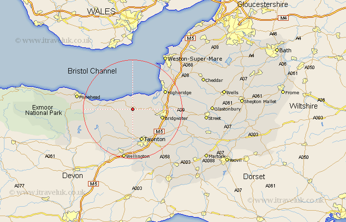
Somerset Map Showing Location of Nether Stowey
Population: 1313
District: Sedgemoor
Easting: 318408 Northing: 139676
Latitude: 51.15 Longitude: -3.17
 = Nether Stowey
District: Sedgemoor
Easting: 318408 Northing: 139676
Latitude: 51.15 Longitude: -3.17
= Nether Stowey
This Nether Stowey map below is supplied by Google. Use the tools in the top left corner to zoom into street level or zoom out for a road map, you may also need to zoom in to see Nether Stowey on the map. Click and drag the map to move around. If the map fails to load try and refresh your browser or zoom in or out (+ or -).
Update - it seems Google no longer allow people to use their maps for free! This Nether Stowey map sometimes loads and sometimes gives a error. I am working on a solution.
Closest 30 Towns or Cities to Nether Stowey (Population over 500)
Nether Stowey 0km Stogursey 4.37km Stoke Courcy 4.37km Stokscourey 4.37km Spaxton 5.09km Otterhampton 6.89km Durleigh 8.94km Bishops Lydeard 9.34km Stogumber 9.49km Kingston 9.9km Watchet 11.77km North Petherton 11.85km Pawlett 12.2km Bridgwater 12.21km Bridgewater 12.21km Norton Fitzwarren 13.03km Taunton 13.44km West Monkton 13.78km Huntspill 13.94km Puriton 14.07km Williton 14.08km Highbridge 14.78km Burnham on Sea 14.86km Burnham 14.86km Burnham-on-Sea 14.86km Oake 15km Milverton 15.92km Berrow 16.66km Wiveliscombe 16.68km Weston Zoyland 16.7km