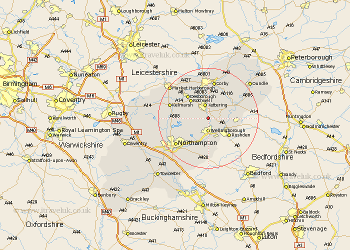
Northamptonshire Map Showing Location of Isham
Population: 743
District: Wellingborough
Easting: 488537 Northing: 273274
Latitude: 52.35 Longitude: -0.7
 = Isham
District: Wellingborough
Easting: 488537 Northing: 273274
Latitude: 52.35 Longitude: -0.7
= Isham
This Isham map below is supplied by Google. Use the tools in the top left corner to zoom into street level or zoom out for a road map, you may also need to zoom in to see Isham on the map. Click and drag the map to move around. If the map fails to load try and refresh your browser or zoom in or out (+ or -).
Update - it seems Google no longer allow people to use their maps for free! This Isham map sometimes loads and sometimes gives a error. I am working on a solution.
Closest 30 Towns or Cities to Isham (Population over 500)
Burton Latimer 2.26km Broughton 4.89km Finedon 4.89km Wellingborough 5.56km Kettering 5.67km Irthlingborough 7.74km Walgrave 8.14km Woodford 9.24km Great Doddington 9.26km Doddington 9.26km Sywell 9.33km Wilby 9.33km Geddington 9.33km Higham Ferrers 9.68km Rowell 10.05km Rothwell 10.05km Ringstead 10.19km Irchester 10.31km Stanwick 10.84km Overstone 10.86km Rushden 10.86km Wollaston 11.35km Raunds 11.47km Earls Barton 11.63km Islip 11.91km Desborough 12.19km Thrapston 12.61km Moulton 12.61km Brigstock 13.03km Stanion 13.41km