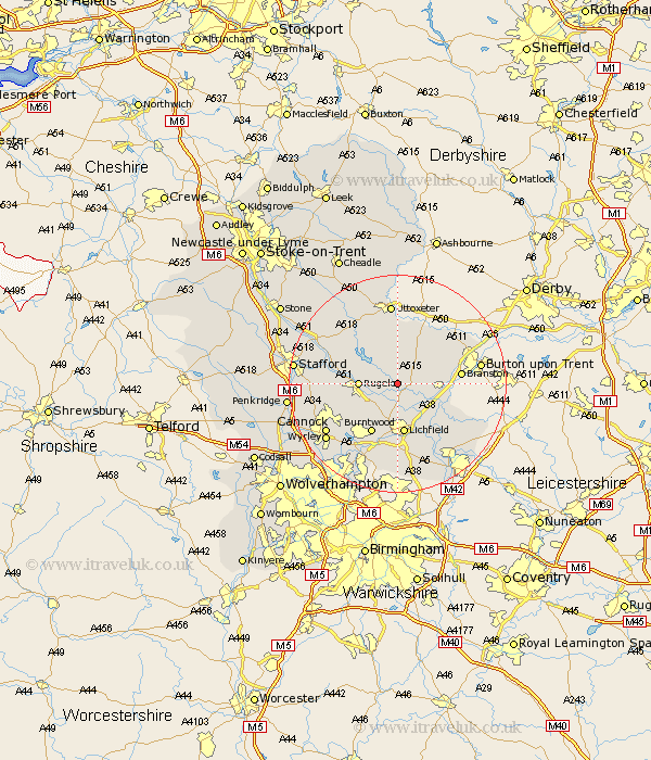
Staffordshire Map Showing Location of Hamstall Ridware
Population: 317
District: Lichfield
Easting: 411244 Northing: 318839
Latitude: 52.77 Longitude: -1.83
 = Hamstall Ridware
District: Lichfield
Easting: 411244 Northing: 318839
Latitude: 52.77 Longitude: -1.83
= Hamstall Ridware
This Hamstall Ridware map below is supplied by Google. Use the tools in the top left corner to zoom into street level or zoom out for a road map, you may also need to zoom in to see Hamstall Ridware on the map. Click and drag the map to move around. If the map fails to load try and refresh your browser or zoom in or out (+ or -).
Update - it seems Google no longer allow people to use their maps for free! This Hamstall Ridware map sometimes loads and sometimes gives a error. I am working on a solution.
Closest 30 Towns or Cities to Hamstall Ridware (Population over 500)
Yoxall 3.84km Armitage 5.01km Colton 5.61km Abbots Bromley 6.49km Longdon 6.5km Rugeley 6.73km Alrewas 8.73km Tatenhill 9.16km Lichfield 9.34km Hanbury 10km Colwich 10.26km Whittington 10.3km Burntwood 10.3km Marchington 11.34km Branston 11.36km Anslow 11.52km Elford 12.15km Edingale 12.53km Norton Canes 12.91km Hatton 13.36km Hammerwich 13.41km Hednesford 13.45km Tutbury 13.69km Rolleston 14.38km Weston upon Trent 14.38km Weston 14.38km Shenstone 14.83km Uttoxeter 14.86km Huntington 15.37km Cannock 15.44km