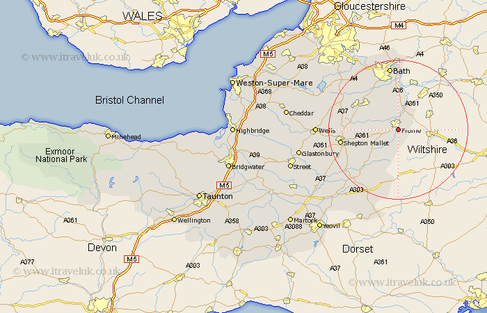
Somerset Map Showing Location of Frome
Population: 22715
Area Size (ha): 582
District: Mendip
Easting: 377885 Northing: 146493
Latitude: 51.22 Longitude: -2.32
 = Frome
Area Size (ha): 582
District: Mendip
Easting: 377885 Northing: 146493
Latitude: 51.22 Longitude: -2.32
= Frome
This Frome map below is supplied by Google. Use the tools in the top left corner to zoom into street level or zoom out for a road map, you may also need to zoom in to see Frome on the map. Click and drag the map to move around. If the map fails to load try and refresh your browser or zoom in or out (+ or -).
Update - it seems Google no longer allow people to use their maps for free! This Frome map sometimes loads and sometimes gives a error. I am working on a solution.
Closest 30 Towns or Cities to Frome (Population over 500)
Nunney 5km Beckington 6.03km Mells 6.09km Rode 7.76km Road 7.76km Leigh-on-Mendip 9.29km Leigh on Mendip 9.29km Leigh upon Mendip 9.29km Leigh 9.29km Norton St Philip 9.34km Norton Saint Philip 9.34km Norton St. Philip 9.34km Kilmersden 9.84km Kilmersdon 9.84km Coleford 9.97km Holcombe 11.75km Wellow 12.05km Freshford 13.02km Stratton 13.92km Stratton on the Fosse 13.92km Chilcompton 13.92km Stratton-on-the-Fosse 13.92km Camerton 14.48km Evercreech 14.77km Redlynch 15.32km Bruton 15.32km Paulton 15.77km Wincanton 15.93km Timsbury 16.06km Shepun 16.68km