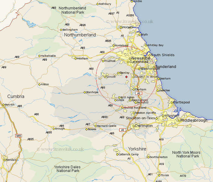
Durham Map Showing Location of Edmondsley
Population: 573
District: Chester-le-Street
Easting: 423540 Northing: 550649
Latitude: 54.85 Longitude: -1.63
 = Edmondsley
District: Chester-le-Street
Easting: 423540 Northing: 550649
Latitude: 54.85 Longitude: -1.63
= Edmondsley
This Edmondsley map below is supplied by Google. Use the tools in the top left corner to zoom into street level or zoom out for a road map, you may also need to zoom in to see Edmondsley on the map. Click and drag the map to move around. If the map fails to load try and refresh your browser or zoom in or out (+ or -).
Update - it seems Google no longer allow people to use their maps for free! This Edmondsley map sometimes loads and sometimes gives a error. I am working on a solution.
Closest 30 Towns or Cities to Edmondsley (Population over 500)
Pelton 2.83km Sacriston 3.85km Chester-le-Street 4.27km Ouston 4.59km Ouston Moor 4.59km Stanley 5.52km Witton Gilbert 5.56km Birtley 5.65km Langley Park 5.96km Annfield Plain 6.4km Lanchester 7.4km Ushaw Moor 7.49km Burnopfield 7.7km Lamesley 7.72km Esh 8.56km Washington 9.31km Washington New Town 9.31km West Rainton 9.31km Rowlands Gill 9.79km Whickham 9.8km Durham 10.2km Gateshead 10.61km Gateshead on Tyne 10.61km Gateshead-on-Tyne 10.61km Houghton le Spring 10.67km Leadgate 10.83km Pittington 11.1km Brandon 11.17km Shincliffe 11.26km Cornsay 11.31km