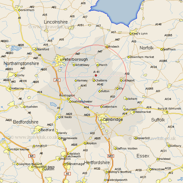
Cambridgeshire Map Showing Location of Doddington
Population: 2767
Area Size (ha): 115
District: Fenland
Easting: 540323 Northing: 289312
Latitude: 52.48 Longitude: 0.07
 = Doddington
Area Size (ha): 115
District: Fenland
Easting: 540323 Northing: 289312
Latitude: 52.48 Longitude: 0.07
= Doddington
This Doddington map below is supplied by Google. Use the tools in the top left corner to zoom into street level or zoom out for a road map, you may also need to zoom in to see Doddington on the map. Click and drag the map to move around. If the map fails to load try and refresh your browser or zoom in or out (+ or -).
Update - it seems Google no longer allow people to use their maps for free! This Doddington map sometimes loads and sometimes gives a error. I am working on a solution.
Closest 30 Towns or Cities to Doddington (Population over 500)
Wimblington 1.86km Chatteris 3.87km March 7.5km Manea 7.9km Mepal 9.86km Sutton 11.35km Somersham 12km Warboys 12.94km Ramsey 12.96km Colne 13.4km Bury 13.51km Downham 13.61km Witchford 14.33km Wistow 14.61km Bluntisham 15.2km Earith 15.2km Whittlesey 15.43km Haddenham 15.86km Littleport 16.23km Wilburton 16.3km Ely 16.42km Stretham 16.48km Elm 18.45km Willingham 18.53km Thorney 18.63km Over 18.83km Needingworth 19.37km Holme 20.4km Wyton 20.8km Swavesey 20.88km