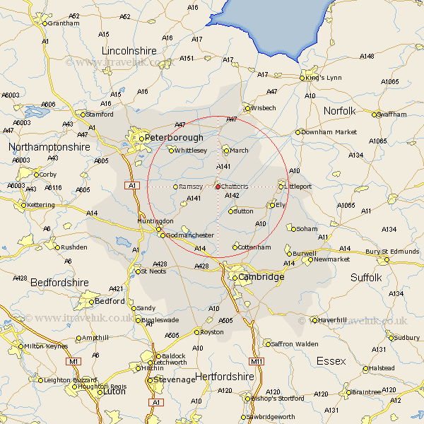
Cambridgeshire Map Showing Location of Chatteris
Population: 7138
Area Size (ha): 224
District: Fenland
Easting: 539297 Northing: 285577
Latitude: 52.45 Longitude: 0.05
 = Chatteris
Area Size (ha): 224
District: Fenland
Easting: 539297 Northing: 285577
Latitude: 52.45 Longitude: 0.05
= Chatteris
This Chatteris map below is supplied by Google. Use the tools in the top left corner to zoom into street level or zoom out for a road map, you may also need to zoom in to see Chatteris on the map. Click and drag the map to move around. If the map fails to load try and refresh your browser or zoom in or out (+ or -).
Update - it seems Google no longer allow people to use their maps for free! This Chatteris map sometimes loads and sometimes gives a error. I am working on a solution.
Closest 30 Towns or Cities to Chatteris (Population over 500)
Doddington 3.87km Wimblington 5.67km Mepal 7.16km Sutton 8.15km Somersham 8.15km Colne 9.53km Warboys 9.67km Manea 9.76km Bury 10.82km Ramsey 11.29km March 11.35km Earith 11.35km Bluntisham 11.35km Wistow 11.59km Witchford 12.59km Haddenham 13.03km Wilburton 13.65km Downham 13.68km Stretham 14.61km Willingham 14.87km Over 14.99km Needingworth 15.5km Ely 15.71km Whittlesey 16.66km Littleport 16.94km Swavesey 17.02km Wyton 17.21km West Hemingford 17.98km Hemingford Abbots 17.98km Fen Stanton 18.46km