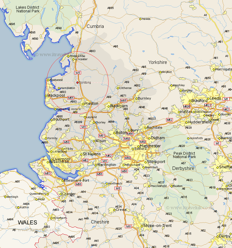
Lancashire Map Showing Location of Garstang
Population: 5573
Area Size (ha): 165
District: Wyre
Easting: 349630 Northing: 445165
Latitude: 53.9 Longitude: -2.77
 = Garstang
Area Size (ha): 165
District: Wyre
Easting: 349630 Northing: 445165
Latitude: 53.9 Longitude: -2.77
= Garstang
This Garstang map below is supplied by Google. Use the tools in the top left corner to zoom into street level or zoom out for a road map, you may also need to zoom in to see Garstang on the map. Click and drag the map to move around. If the map fails to load try and refresh your browser or zoom in or out (+ or -).
Update - it seems Google no longer allow people to use their maps for free! This Garstang map sometimes loads and sometimes gives a error. I am working on a solution.
Closest 30 Towns or Cities to Garstang (Population over 500)
Garstang 0km Catterall 3.7km Claughton-on-Brock 4.94km Claughton 4.94km Claughton on Brock 4.94km Forton 5.67km Cockerham 6.45km Eccleston 8.6km Great Eccleston 8.6km Inskip 8.61km Barton 9.52km Broughton 9.52km Pilling 10.5km Elswick 10.65km Woodplumpton 11.17km Goosnargh 11.35km Hambleton 11.54km Chipping 12.16km Overton 12.38km Singleton 13.21km Great Singleton 13.21km Preesall 13.23km Middleton 13.49km Longridge 14.13km Grimsargh 14.15km Kirkham 14.54km Lea 14.98km Lea Town 14.98km Preston 15.18km Poulton le Fylde 16.03km