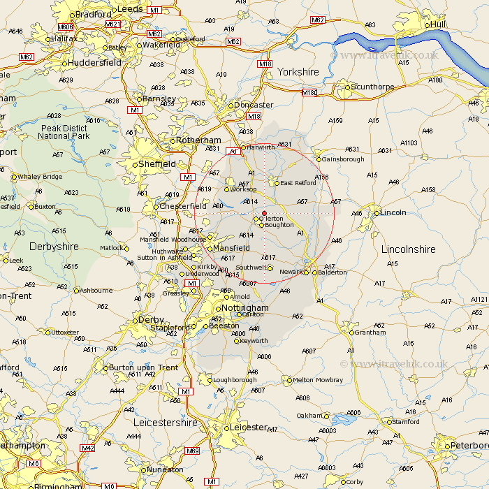
Nottinghamshire Map Showing Location of Bothamsall
Population: 185
District: Bassetlaw
Easting: 467853 Northing: 371209
Latitude: 53.23 Longitude: -0.98
 = Bothamsall
District: Bassetlaw
Easting: 467853 Northing: 371209
Latitude: 53.23 Longitude: -0.98
= Bothamsall
This Bothamsall map below is supplied by Google. Use the tools in the top left corner to zoom into street level or zoom out for a road map, you may also need to zoom in to see Bothamsall on the map. Click and drag the map to move around. If the map fails to load try and refresh your browser or zoom in or out (+ or -).
Update - it seems Google no longer allow people to use their maps for free! This Bothamsall map sometimes loads and sometimes gives a error. I am working on a solution.
Closest 30 Towns or Cities to Bothamsall (Population over 500)
Ollerton 2.89km Boughton 3.76km Elksley 3.88km Elkesley 3.88km Tuxford 6.91km Markham 6.91km East Markham 6.91km Edwinstowe 7.86km Grove 9.26km East Retford 9.85km Clipstone 10.73km Bilsthorpe 11.61km Warsop 11.7km Worksop 12.43km Sutton 12.98km Hayton 14.11km Clarborough 14.11km Rampton 14.27km Bampton 14.27km North Leverton 14.45km Ranskill 15km Ramskill 15km Farnsfield 15.19km Shireoaks 15.32km Rainworth 15.72km Blyth 15.83km Mansfield Woodhouse 16.22km Muskham 17.07km North Muskham 17.07km Southwell 17.15km