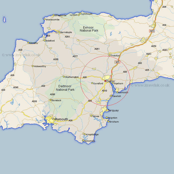
Devon Map Showing Location of Alphington
District: Exeter
Easting: 291727 Northing: 90113
Latitude: 50.7 Longitude: -3.53
 = Alphington
Easting: 291727 Northing: 90113
Latitude: 50.7 Longitude: -3.53
= Alphington
This Alphington map below is supplied by Google. Use the tools in the top left corner to zoom into street level or zoom out for a road map, you may also need to zoom in to see Alphington on the map. Click and drag the map to move around. If the map fails to load try and refresh your browser or zoom in or out (+ or -).
Update - it seems Google no longer allow people to use their maps for free! This Alphington map sometimes loads and sometimes gives a error. I am working on a solution.
Closest 30 Towns or Cities to Alphington (Population over 500)
Ide 2.35km Exminster 3.98km Whitestone 5.98km Topsham 6.16km Holcombe Burnell 7.28km Stoke Canon 7.78km St Cyres 8.78km Newton St Cyres 8.78km Newton Saint Cyres 8.78km St. Cyres 8.78km Newton St. Cyres 8.78km Saint Cyres 8.78km Kenton 8.78km Woodbury Road Station 9.57km Lympstone 9.92km Christow 9.92km Broad Clyst 10.22km Dunsford 10.73km Starcross 10.97km Thorverton 11.12km Tedburn St Mary 11.19km Tedburn St. Mary 11.19km Tedburn Saint Mary 11.19km Chudleigh 11.66km Aylesbeare 11.88km Rockbeare 11.93km Crediton 12.38km Silverton 13.44km Exmouth 13.46km Dawlish 13.8km