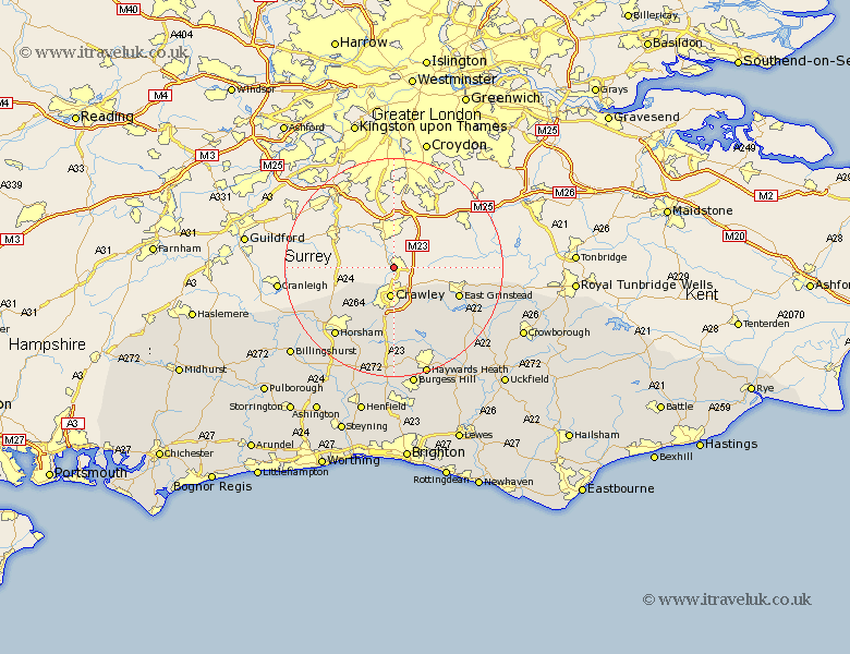
Sussex Map Showing Location of Gatwick
District: Crawley
Easting: 527000 Northing: 142454
Latitude: 51.17 Longitude: -0.18
 = Gatwick
Easting: 527000 Northing: 142454
Latitude: 51.17 Longitude: -0.18
= Gatwick
This Gatwick map below is supplied by Google. Use the tools in the top left corner to zoom into street level or zoom out for a road map, you may also need to zoom in to see Gatwick on the map. Click and drag the map to move around. If the map fails to load try and refresh your browser or zoom in or out (+ or -).
Update - it seems Google no longer allow people to use their maps for free! This Gatwick map sometimes loads and sometimes gives a error. I am working on a solution.
Closest 30 Towns or Cities to Gatwick (Population over 500)
Crawley 5.6km Worth 8.2km Rusper 9.42km Turners Hill 11.61km East Grinstead 12.89km Balcombe 13.79km Warnham 13.98km Forest Row 13.99km Slaugham 14.88km Ardingly 16.39km Horsham 16.67km West Horsham 16.67km Cuckfield 17.04km South Nutfield 17.04km Lower Beeding 17.32km Rudgwick 18.95km Slinfold 19.93km Nuthurst 20.25km Lindfield 20.25km Southwater 20.34km Horsted Keynes 20.34km Itchingfield 20.37km Botney 20.43km Bolney 20.43km Cowfold 21.21km Haywards Heath 21.21km Baywards Heath 21.21km Burgess Hill 22.51km Hartfield 22.9km Withyham 23.97km