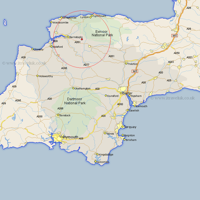
Devon Map Showing Location of West Buckland
Population: 456
District: North Devon
Easting: 265719 Northing: 131514
Latitude: 51.07 Longitude: -3.92
 = West Buckland
District: North Devon
Easting: 265719 Northing: 131514
Latitude: 51.07 Longitude: -3.92
= West Buckland
This West Buckland map below is supplied by Google. Use the tools in the top left corner to zoom into street level or zoom out for a road map, you may also need to zoom in to see West Buckland on the map. Click and drag the map to move around. If the map fails to load try and refresh your browser or zoom in or out (+ or -).
Update - it seems Google no longer allow people to use their maps for free! This West Buckland map sometimes loads and sometimes gives a error. I am working on a solution.
Closest 30 Towns or Cities to West Buckland (Population over 500)
Swimbridge 3.96km Bratton Fleming 6.03km Chittlehampton 6.03km South Molton 8.05km North Molton 8.36km Barnstaple 9.5km Tawstock 9.5km High Bickington 12.56km Marwood 12.9km Fremington 13.98km Barrington 15.02km Burrington 15.02km Combe Martin 16.91km Chulmleigh 17.04km Instow 17.57km Lynton 17.66km Linton 17.66km West Down 17.85km Berrynarbor 18.14km Braunton 18.99km Chawleigh 19.43km Appledore 19.89km Great Torrington 20.85km Torrington 20.85km Georgeham 21.12km Northam 21.3km Bideford 21.7km Iltracombe 21.74km Ilfracombe 21.74km Witheridge 21.78km