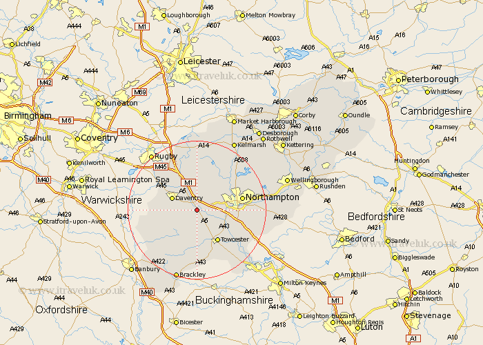
Northamptonshire Map Showing Location of Weedon
Population: 2485
District: Daventry
Easting: 463756 Northing: 258064
Latitude: 52.22 Longitude: -1.07
 = Weedon
District: Daventry
Easting: 463756 Northing: 258064
Latitude: 52.22 Longitude: -1.07
= Weedon
This Weedon map below is supplied by Google. Use the tools in the top left corner to zoom into street level or zoom out for a road map, you may also need to zoom in to see Weedon on the map. Click and drag the map to move around. If the map fails to load try and refresh your browser or zoom in or out (+ or -).
Update - it seems Google no longer allow people to use their maps for free! This Weedon map sometimes loads and sometimes gives a error. I am working on a solution.
Closest 30 Towns or Cities to Weedon (Population over 500)
Flore 2.17km Bugbrooke 3.88km Harpole 5.97km Pattishall 6.52km Kislingbury 6.81km Daventry 7.75km Badby 7.95km Gayton 8.8km Long Buckby 9.26km Welton 9.33km East Haddon 9.87km Blisworth 10.65km Towcester 10.88km Milton 10.88km Braunston 11.71km Collingtree 11.95km Hardingstone 12.63km Byfield 12.65km West Haddon 12.97km Northampton 13.02km Wootton 13.04km Boughton 13.55km Spratton 13.66km Crick 13.74km Guilsborough 13.74km Barby 14.35km Roade 14.53km Kilsby 14.64km Silverstone 15.22km Helmdon 15.51km