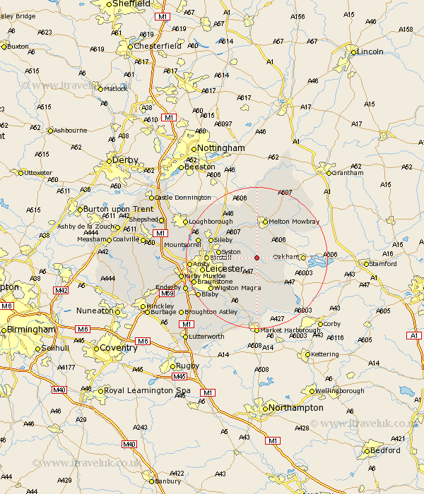
Leicestershire Map Showing Location of Twyford
Population: 612
District: Melton
Easting: 473253 Northing: 308254
Latitude: 52.67 Longitude: -0.92
 = Twyford
District: Melton
Easting: 473253 Northing: 308254
Latitude: 52.67 Longitude: -0.92
= Twyford
This Twyford map below is supplied by Google. Use the tools in the top left corner to zoom into street level or zoom out for a road map, you may also need to zoom in to see Twyford on the map. Click and drag the map to move around. If the map fails to load try and refresh your browser or zoom in or out (+ or -).
Update - it seems Google no longer allow people to use their maps for free! This Twyford map sometimes loads and sometimes gives a error. I am working on a solution.
Closest 30 Towns or Cities to Twyford (Population over 500)
Gaddesby 5.01km Somerby 5.62km Houghton on the Hill 7.15km Houghton-on-the-Hill 7.15km Houghton 7.15km Billesdon 7.5km Queniborough 8.08km Queniboro 8.08km Frisby-on-the-Wreak 8.14km Frisby on the Wreak 8.14km Frisby 8.14km Hoby 9.29km Rearsby 9.63km Syston 10.28km Melton Mowbray 11.34km Abkettley 12.96km Ab Kettleby 12.96km Birstall 13.49km Sileby 13.55km Great Glen 13.63km Hallaton 14.14km Oadby 14.58km Rothley 15.07km Leiscester 15.08km Leicester 15.08km Scalford 15.2km Wymondham 15.44km Wigston 15.46km Wigston Magna 15.46km Kibworth Harcourt 15.5km