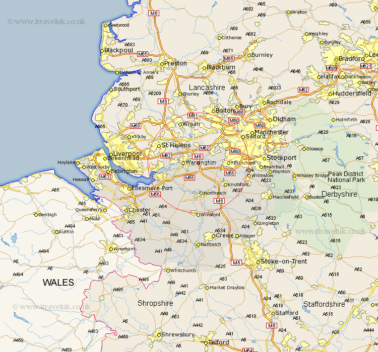
Cheshire Map Showing Location of Thelwall
Population: 22248
Area Size (ha): 646
Easting: 365637 Northing: 387537
Latitude: 53.38 Longitude: -2.52
 = Thelwall
Area Size (ha): 646
Easting: 365637 Northing: 387537
Latitude: 53.38 Longitude: -2.52
= Thelwall
This Thelwall map below is supplied by Google. Use the tools in the top left corner to zoom into street level or zoom out for a road map, you may also need to zoom in to see Thelwall on the map. Click and drag the map to move around. If the map fails to load try and refresh your browser or zoom in or out (+ or -).
Update - it seems Google no longer allow people to use their maps for free! This Thelwall map sometimes loads and sometimes gives a error. I am working on a solution.
Closest 30 Towns or Cities to Thelwall (Population over 500)
Thelwall 0km Stockton Heath 0.59km Risley 3.71km Appleton 4.31km Warrington 5.53km High Legh 5.77km Lymm 5.83km Croft 5.98km Glazebrook 6.47km Stretton 6.48km Great Sankey 6.63km Sankey 6.63km Culcheth 7.42km Partington 7.6km Winwick 7.84km Mere 8.66km Bowdon 10.12km Altrincham 11.05km Burtonwood 11.39km Preston Brook 11.54km Preston on the Hill 11.54km Preston-on-the-Hill 11.54km Anderton 13.01km Marston 13.01km Northwick 13.01km Northwich 13.01km Lostock Gralam 13.38km Knutsford 13.6km Acton 14.1km Halton 14.24km