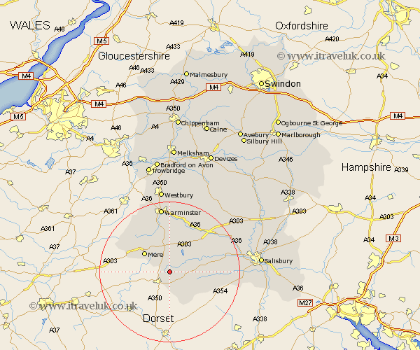
Wiltshire Map Showing Location of Semley
Population: 647
District: Salisbury
Easting: 389483 Northing: 126063
Latitude: 51.03 Longitude: -2.15
 = Semley
District: Salisbury
Easting: 389483 Northing: 126063
Latitude: 51.03 Longitude: -2.15
= Semley
This Semley map below is supplied by Google. Use the tools in the top left corner to zoom into street level or zoom out for a road map, you may also need to zoom in to see Semley on the map. Click and drag the map to move around. If the map fails to load try and refresh your browser or zoom in or out (+ or -).
Update - it seems Google no longer allow people to use their maps for free! This Semley map sometimes loads and sometimes gives a error. I am working on a solution.
Closest 30 Towns or Cities to Semley (Population over 500)
Semley 0km Bishop's Knoyle 3.89km East Knoyle 3.89km Tisbury 5.96km Hindon 7.51km Mere 8.93km Fovant 10.65km Dinton 12.91km Zeal 13.81km Zeals 13.81km Codford 14.74km Longbridge Deverill 15.24km Broad Chalke 15.27km Heytesbury 16.84km Bishopstone 17.58km Warminster 18.68km Steeple Langford 18.78km Longford 18.78km Wilton 20.57km Combebissett 20.98km Coombe Bissett 20.98km South Newton 21.14km Corsley 21.55km Dilton 22.51km Shrewton 24.14km Westbury 24.21km Odstock 25.64km Salisbury 25.9km New Sarum 25.9km Bratton 26.06km